.jpeg)
Abel Tasman National Park
New Zealand40.83°S 172.90°E · 440 m
149 places in the index.
40.83°S 172.90°E · 440 m
36.84°S 174.77°E · 196 m
43.53°S 172.62°E · 20 m
45.87°S 170.50°E
43.46°S 170.02°E
43.38°S 170.18°E
37.78°S 175.28°E · 40 m
42.72°S 170.97°E · 2 m
46.41°S 168.37°E · 0 m
42.42°S 173.68°E
44.00°S 170.48°E
41.12°S 173.01°E
39.48°S 176.92°E · 160 m
41.27°S 173.28°E · 0 m
45.08°S 170.98°E
40.35°S 175.61°E · 46 m
41.28°S 174.00°E
42.11°S 171.34°E
45.03°S 168.66°E
38.14°S 176.25°E · 280 m
47.00°S 167.84°E · 980 m
40.85°S 172.80°E
38.69°S 176.07°E · 360 m
45.42°S 167.72°E
36.80°S 175.08°E · 231 m
44.70°S 169.14°E · 290 m
41.29°S 174.78°E · 0 m
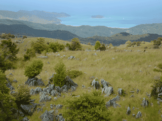
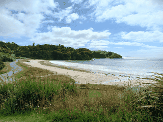
The Abel Tasman National Park is a stunning coastal park on the northern tip of New Zealand's South Island, known for its golden beaches, clear waters, and the famous Abel Tasman Coast Track. Access is on foot or by boat; vehicles are not allowed inside the park.
Akaroa is the only French settlement in New Zealand, founded in 1840 when French settlers arrived to establish a colony only to find British troops had already claimed the territory. The village preserves its Gallic character through street names like Rue Lavaud, Rue Balguerie, and Rue Jolie, while the surrounding volcanic harbour shelters the world's rarest dolphin—the endemic Hector's dolphin.
Atlas entry
Alexandra is a small town in the Central Otago district of Otago, situated on the banks of the Clutha River at its confluence with the Manuherikia River. It is on State Highway 8, 188 km by road from Dunedin and 33 km south of Cromwell.
Atlas entry
Arrowtown is a picturesque gold mining village in the Wakatipu Basin, 20 minutes from Queenstown. It survives on its determinedly preserved heritage—miners' cottages, wooden buildings, tree-lined streets, and 19th-century-style shops stand much as they did during the gold rush.
Atlas entry
Arthur's Pass National Park is a major national park in the heart of New Zealand's South Island. The park is a popular stop from the TranzAlpine train and has hikes both long and short.
Atlas entry
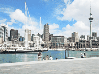
Auckland is New Zealand's largest city, home to 1.5 million people, nearly one-third of the country's population. It is a vibrant multicultural city set around two big natural harbours, ranked as one of the most liveable cities in the world.
Blenheim is the most populous town in the Marlborough wine-growing region on New Zealand's South Island. It is one of the sunniest towns in the country, with warm dry summers and cool frosty winters.
Atlas entry
Bluff is the southernmost town on the New Zealand mainland, serving as the departure point for ferries to Stewart Island. The town is famous for its oysters, best enjoyed from March to August, and offers a charming maritime heritage with the Bluff Maritime Museum.
Atlas entry
Cambridge offers a peaceful, tree-lined escape with a distinctly English character that contrasts with larger New Zealand cities. The town earns its nickname 'Town of Trees' through mature plantings along its streets and gardens.
Atlas entry
Carterton is a small farming town in the Wairarapa district, sitting along State Highway 2 between Wellington and Masterton. It serves as a practical stop for road travelers and a base for accessing the Tararua Ranges for tramping.
Atlas entry
Charleston is a quiet coastal hamlet in New Zealand's Buller District, where the echoes of a 1860s gold rush still linger among the rocky shores and mountain tracks. Today it serves as a gateway to underground adventures—glow-worm cave exploration, underworld rafting, and vertical rock climbing along dramatic coastline.
Atlas entry
The Chatham Islands offer a remote, unspoiled experience with unique wildlife, endemic plants, and a blend of Moriori, Maori, and European cultures. It's a place where you can see rare birds like the Magenta petrel and Chatham albatross, walk on beaches without crowds, and explore ancient rock carvings.
Atlas entry
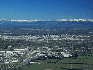
Christchurch is the largest city on the South Island of New Zealand, situated on the Canterbury Plains just north of Banks Peninsula. With a population of 385,000, it serves as the major international entry point for exploring the rest of the South Island.
Collingwood is the main settlement in the far northwest of Golden Bay, serving as the departure point for tours along Farewell Spit, one of New Zealand's most distinctive natural features. At the height of the Victorian gold rush, Collingwood was even proposed as the capital of New Zealand, giving it a surprising historical gravitas.
Atlas entry
Coromandel is a small historic town on the western side of Coromandel Peninsula, serving as a gateway to the peninsula's natural attractions. The town has gold-mining heritage dating to the 1800s, evident in sites like the Coromandel Goldfield Centre and School of Mines Museum.
Atlas entry
Cromwell, originally known as 'The Junction', is a historic gold rush town in central Otago that expanded rapidly after gold was discovered nearby in 1862. The town sits at the confluence of the Clutha and Kawarau Rivers, surrounded by picturesque landscapes where both rivers have cut beautiful gorges.
Atlas entry
Dannevirke is a town in the southern Hawke's Bay region, in the eastern North Island of New Zealand. Its name derives from Danish and means 'a work of the Danes'.
Atlas entry
Dargaville is a small Northland town best known as the kumara (sweet potato) capital of New Zealand, where the vast majority of the country's crop is grown. It sits at the heart of kauri country, surrounded by the giant native trees that once dominated the region, and is linked to the history of kauri gum—fossilised resin once harvested for varnish and decorative items.
Atlas entry
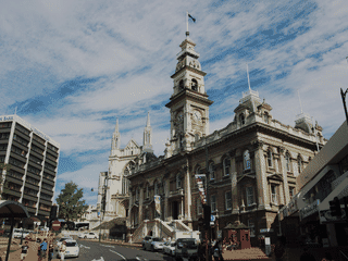
Dunedin is a university town, cultural hub, and historic city with a compact walkable centre. Known as the 'Edinburgh of the South', it offers easy access to beaches, wildlife, and native forests.
Egmont National Park (Maori: Te Papakura o Taranaki) was established in 1900 as New Zealand's second national park, centered on the symmetrical stratovolcano of Mount Taranaki. The park offers accessible day hiking to the summit and ski areas on the eastern slopes, with the added draw of free entry unlike many international parks.
Atlas entry
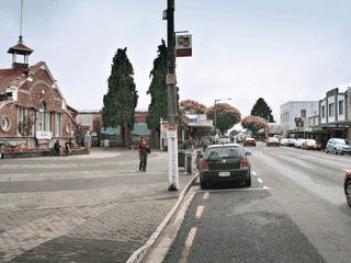
Fairlie is a small rural town in the Mackenzie District of South Canterbury, New Zealand. It is best known for having one of the nicest and cleanest public toilets in New Zealand, which features underfloor heating.
Atlas entry
Feilding is a rural servicing town on the Manawatu plain that offers a genuine taste of New Zealand farm country. The town is most famous for its saleyards—the biggest sheep and cattle sales in the Southern Hemisphere—held twice weekly just 100 meters from the shopping center.
Atlas entry
Fiordland National Park covers 12,607 km² of New Zealand's southwest corner, making it the country's largest national park. As a UNESCO World Heritage site with snow-capped mountains, ancient fiords, and one of New Zealand's wildest landscapes, it offers unparalleled wilderness experiences.
Atlas entry
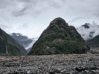
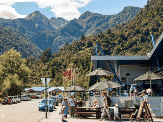
Fox Glacier village offers a quieter, more intimate atmosphere than its larger neighbor Franz Josef, making it ideal for travelers seeking fewer crowds. The township sits in Glacier Country on the West Coast of New Zealand's South Island, tucked into rainforest-clad foothills of the Southern Alps with stunning outlooks across surrounding farms.
Franz Josef is a small West Coast village built around one of New Zealand's most dramatic natural attractions: the Franz Josef Glacier, a 11-km-long frozen river descending from Mount Cook to near sea level. The area draws up to 550,000 visitors annually who come for guided glacier walks, heli-hiking experiences, scenic helicopter flights, and the unique opportunity to walk on ancient ice.
Gisborne is a small sunny beachside city on the East Coast of New Zealand's North Island, popular as a holiday destination especially in summer. It boasts a warm, dry, and sunny climate, swimming and surf beaches, wineries, and a more relaxed pace of life than larger cities.
Atlas entry
Glenorchy sits at the northern tip of Lake Wakatipu with sweeping views of the Richardson and Humboldt ranges. The town is the last stop before Fiordland and serves as a staging point for hikers on the Routeburn Track, Dart River walks, and Rees-Dart jet boat trips.
Atlas entry
Gore is a small Southland town of 8,200 people that punches above its weight as the self-declared world capital of brown trout fishing. The Mataura River running through town draws fly fishers globally, and the town doubles as New Zealand's country music capital with the Gold Guitar Awards held each June.
Atlas entry
Granity is a small former coal and gold mining town on State Highway 67, the first settlement north of Westport on New Zealand's West Coast. It offers historic mining heritage sites, access to the Old Ghost Road track, and proximity to the former mining communities of Millerton, Hector, and Ngakawau.
Atlas entry
Great Barrier Island (Māori: Aotea) is a remote 285 km² island in the outer Hauraki Gulf, 90 km northeast of Auckland. With a population under 1,000, it offers pristine natural environments: regenerating kauri forest, rare native wildlife (kākā, brown teal, black petrel), spectacular surf beaches and an International Dark Sky Sanctuary designation.
Atlas entry
Greymouth is the largest town on the West Coast and the turnaround point for the Tranz Alpine train, one of the world's top train journeys. The town sits at the mouth of the Grey River, with a long gold-mining history and scenic walkways along the river and parks.
Atlas entry
Haast is a tiny scattered settlement at the southern end of the West Coast, sitting at the boundary of Mount Aspiring National Park and the Te Wahipounamu World Heritage Area. Travelers typically stop here en route between Wanaka and the glacier towns, drawn by the dramatic coastal rainforest, river valleys, and access to some of New Zealand's most untouched wilderness.
Atlas entry
Hahei is a tiny seaside town on the Coromandel Peninsula where fewer than 300 residents transform into thousands during peak holiday periods. The main draw is Te Whanganui-A-Hei Marine Reserve, home to Cathedral Cove with its famous limestone rock arch separating two sandy beaches.
Atlas entry
Hamilton serves as a convenient hub for exploring the central North Island, with Hobbiton, Waitomo Caves, and Raglan beach all within 90 minutes. The city itself offers Hamilton Gardens, the Waikato Museum, and seasonal festivals like Balloons over Waikato in April and the Agricultural Fieldays in June.
Hanmer Springs is a small spa resort town built around natural thermal hot springs in the Canterbury region of New Zealand's South Island. The town sits at the edge of Hanmer Forest Park, offering mountain biking trails, quad biking tours through high-country landscape, and walking tracks through native forest.
Atlas entry
Hastings is the food-producing capital of New Zealand, offering cuisine unrivalled anywhere else in the country. The city receives 2200 hours of sunshine annually, making it one of the sunniest places in New Zealand.
Havelock is the green-shell mussel capital of the world and serves as the major gateway to the Pelorus Sound, one of the two major sounds of the Marlborough Sounds. The town has an unexpected scientific claim to fame: Sir Ernest Rutherford, the first man to split the atom, and rocket scientist William Pickering both had their formative education here.
Atlas entry
Havelock North is a town of 14,000 residents in Hawke's Bay on New Zealand's North Island, often called 'the Village' by locals in reference to its farming village origins. Despite its size, it maintains a distinct village character separate from nearby Hastings.
Atlas entry
Hawera is the second-largest town in the Taranaki region with about 11,050 residents. The town is best known for its distinctive water tower, built after major fires in the early 1900s, and serves as a practical stop for travelers exploring the Taranaki region.
Atlas entry
Helensville is a small town of about 3,000 people sitting on the tidal Kaipara River at the southern end of the large Kaipara Harbour, 40 km from Auckland. It's a quiet alternative to the city, with the smaller settlement of Parakai just 3 km northwest offering natural thermal pools and a skydiving airfield.
Atlas entry
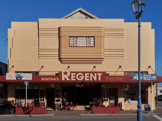
Hokitika is the main service town for the southern West Coast, positioned as a convenient stopover on State Highway 6 between the Franz Josef and Fox glaciers to the south and Greymouth to the north. The town was rebuilt after a devastating 1869 fire and retains some handsome historic buildings from its gold-rush heyday when it ranked first in New Zealand for ship traffic.
Horeke is the oldest European settlement in the Hokianga and the second oldest in all of New Zealand, founded as 'Deptford' and later renamed for a Maori term meaning 'the throwing of a spear'. It was the first centre of timber trading in the region, and today visitors can walk between historic buildings on stilts over the harbour, a plaque marking the first commercial ship-building yard in New Zealand, and Ruapapaka Island where the country's first legal execution took place in 1838.
Atlas entry
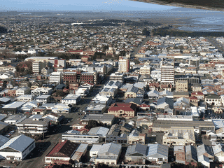
Invercargill is the most southerly and westerly city in New Zealand, a Victorian-era time capsule with wide streets and century-old buildings that evoke the sedate pace of 19th-century commerce. The city serves as the main centre of the Southland region and a base for exploring southern New Zealand, with access to Stewart Island, the Catlins, and Fiordland.
Kaiapoi is a small town just 17 km north of Christchurch on the east coast of New Zealand's South Island, straddling the Waimakariri River. It functions primarily as a commuter suburb of Christchurch while maintaining its own distinct community identity.
Atlas entry
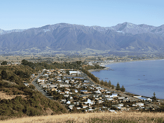
Kaikoura is a small coastal town on New Zealand's South Island where the Seaward Kaikoura mountains rise dramatically from the Pacific Ocean. The town is famous for marine wildlife encounters — whales, dolphins, seals, and albatross — all visible from boat tours or while kayaking.
Kaitaia serves as the practical gateway to the Far Far North, being the largest town (6,000 residents) in the region and the last settlement of any size before Cape Reinga. The town sits 13 km south of Ninety Mile Beach's southern end at Ahipara, making it an ideal base for exploring one of New Zealand's most remote stretches of coastline.
Atlas entry
Karamea is a remote settlement of roughly 650 residents at the northern end of New Zealand's West Coast. The town sits on a narrow coastal strip with Kahurangi National Park completely encircling it to the south, east, and north.
Atlas entry
Kerikeri is often described as the Cradle of the Nation as the site of the first permanent mission station in New Zealand, featuring some of the most historic buildings in the country. Located in the Winterless North of the North Island, this rapidly-expanding town sits at the western extremity of the Kerikeri Inlet where the Kerikeri River meets the salty Bay of Islands.
Atlas entry
Kohukohu is a small artistic township on the northern shore of Hokianga Harbour in Northland, New Zealand. The town serves as a gateway for exploring the harbour and nearby beaches, with the Village Arts Gallery showcasing local and Maori art.
Atlas entry
Kuaotunu is a small coastal township on the east coast of the Coromandel Peninsula in New Zealand's North Island. It is one of the most northern beaches on the Coromandel's east coast and a popular destination for summer holidays.
Atlas entry
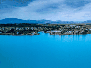
Lake Tekapo is a small resort village on the shores of a stunning turquoise glacier-fed lake in New Zealand's Southern Alps. The village is internationally recognized for its exceptional dark skies, making it the premier stargazing destination in the Southern Hemisphere.
Leigh is a tiny coastal town with fewer than 500 residents, famous for sitting next to Goat Island Marine Reserve, New Zealand's first marine reserve established in 1975. The clear waters offer world-class snorkeling and diving just meters from shore, with abundant fish and marine life protected inside the reserve boundaries.
Atlas entry
Levin is a town of 19,000 people (2022) in the Manawatu region of New Zealand's North Island. It is the largest town in the Horowhenua District, nestled beneath the Tararua Ranges and near Lake Horowhenua.
Atlas entry
Long Bay offers Aucklanders and visitors a rare escape without leaving the city—the Long Bay-Okura Marine Reserve protects 1 km of white sand beach edged by rural countryside. The park provides a tree-lined environment with playgrounds, picnic areas, and walking tracks, making it popular with families and outdoor enthusiasts seeking beach activities, nature walks, and water sports.
Atlas entry
Lyttelton is the seaport satellite town of Christchurch, sitting in the caldera of an extinct volcano just over the Port Hills. Its steep streets give the town a distinctive European charm that contrasts sharply with flat Christchurch.
Atlas entry
Mapua is a small town in the Nelson Bays region of New Zealand, located near Nelson. It makes a pleasant visit for its waterside restaurants and serves as a base for exploring nearby wineries.
Atlas entry
Martinborough is a small wine-producing town in the Wairarapa district with a population of 1900 (2025). The town was laid out by John Martin in 1879, with streets arranged in a Union Jack pattern.
Atlas entry
Masterton is the largest town in the Wairarapa region, serving as a base for exploring Martinborough wineries, Tararua Forest Park tramping, and regional festivals. The town itself offers practical services, local museums, and access to rural New Zealand without Wellington's crowds or costs.
Atlas entry
Matamata is world-famous as the departure point for Hobbiton Movie Set tours, the filming location used for the Shire in The Lord of the Rings and The Hobbit trilogies. Beyond Middle-earth, the town serves as a practical transit hub on the Auckland-Rotorua route through rural Waikato farmland.
Atlas entry
Mataura is a small rural service town in Southland useful as a stopover when traveling between Invercargill and Dunedin via State Highway 1. The town is known for brown trout fishing in the Mataura River and has a small heritage museum.
Atlas entry
Matawai is a hamlet of fewer than 100 residents on State Highway 2, positioned halfway between Gisborne and Opotiki along the upper Motu River. Despite its size, it draws adventurers specifically for the Motu Road Trail—a 67 km cycle route following the first vehicle road into the region—and for kayaking opportunities on the Motu River itself.
Atlas entry
Methven is a small Canterbury town of 1,900 people that serves as the primary accommodation base for Mt. Hutt ski area.
Atlas entry
Milton is a tiny settlement of about 2,000 residents in the Otago region, essentially functioning as a rest stop on State Highway 1. For most travelers driving between Dunedin and Invercargill, it serves as a convenient place to break the journey rather than a destination in its own right.
Atlas entry
Morere is a small locality at the base of the Mahia Peninsula in northern Hawke's Bay, famous for its natural hot springs set within native forest. It serves as a convenient stopping point for drivers traveling between Gisborne and Wairoa, offering a chance to relax in thermal pools surrounded by bush.
Atlas entry
Motueka serves as the primary gateway to Abel Tasman and Kahurangi National Parks, making it essential for visitors to New Zealand's South Island seeking coastal adventures. The area boasts one of the country's highest annual sunshine-hour indices, attracting holidaymakers to nearby beaches at Kaiteriteri and Marahau.
Atlas entry
Aoraki / Mount Cook National Park is New Zealand's alpine heartland, home to 22 of the country's 23 peaks over 3,000 metres including Aoraki / Mount Cook (3,724 m) and Mount Tasman (3,498 m). The park covers 707 km² within the Te Wahipounamu UNESCO World Heritage site, offering world-class trekking, mountaineering, glacier experiences, and stargazing under some of the southern hemisphere's clearest skies.
Murchison is a small township in New Zealand positioned on State Highway 6 between the West Coast and Nelson. It serves primarily as a transit stop for travelers moving between these regions.
Atlas entry
Muriwai is a relaxed beach village on Auckland's wild west coast, 42 km from the city center. The star attraction is the gannet breeding colony on Otakamiro Point, the most easily accessible gannet colony in New Zealand, with viewing platforms just steps from the village.
Atlas entry
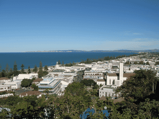
Napier is the world's most consistently Art Deco city, rebuilt after a magnitude 7.8 earthquake in 1931 destroyed much of the CBD and killed 256 people. Over 100 Art Deco buildings remain in the city center, most restored and heritage-listed.
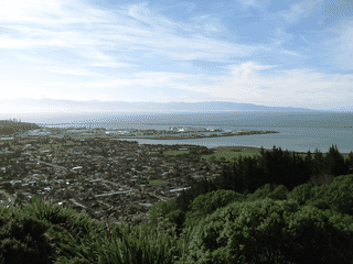
Nelson is New Zealand's sunniest city with over 2,500 hours of sunshine annually, making it an ideal year-round destination. The city is unique as the smallest city in the world to have its own symphony orchestra and is surrounded by three national parks: Abel Tasman, Kahurangi, and Nelson Lakes.
Nelson Lakes National Park offers pristine alpine wilderness with greywacke mountains fringed by native beech forest exuding sugary sap that supports a unique food chain. The park protects Lakes Rotoiti and Rotoroa, home to humungous native eels and brown trout.
Atlas entry
New Plymouth is the largest city in the Taranaki region with an urban population of 58,000 (2021), serving as the main commercial centre. The city lies on the coastal plains northwest of Mount Taranaki (Egmont), offering views of the iconic volcanic cone.
Atlas entry
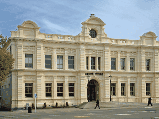
Oamaru offers a rare combination of Victorian architecture and wildlife encounters in a small New Zealand town. The historic Harbour & Tyne Historic Precinct preserves the most complete Victorian streetscape in the country, built from locally quarried Oamaru stone.
Ohakune is New Zealand's self-proclaimed ski capital of the North Island, sitting at the base of Mount Ruapehu. The town of 1,400 residents transforms each winter into a bustling hub for skiers and snowboarders from across New Zealand and Australia.
Atlas entry
Omarama is a tiny Mackenzie Country town with fewer residents than parked gliders, yet it draws aviation enthusiasts from around the world to its world-famous gliding centre. Between September and April, scenic flights into the Southern Alps offer unmatched aerial views of New Zealand's highest peaks.
Atlas entry
Opononi and its neighbour Omapere sit on the southern shore of Hokianga Harbour on State Highway 12 in Northland. The twin towns are famous for Opo, a bottlenose dolphin who befriended local children in the 1950s before tragically dying; a statue commemorates this legendary creature on the waterfront.
Atlas entry
Opotiki is a small coastal town in the eastern Bay of Plenty on New Zealand's North Island. It serves as the starting point for State Highway 35, which follows much of the coastline of the East Cape and terminates in Gisborne.
Atlas entry
Otaki is a bargain-hunter's paradise on New Zealand's Kapiti Coast. The town has reinvented itself with outlet shopping along State Highway 1, featuring stores like Pumpkin Patch, Bendon, Billabong, Kathmandu, and Ice Breaker alongside boutique gift and shoe shops.
Atlas entry
Paekākāriki is a small coastal town at the southern end of the Kapiti Coast, offering a quieter alternative to nearby Paraparaumu. The town has historical significance as a WWII US Marine station and provides access to the Queen Elizabeth II Park memorial.
Atlas entry
Paihia is a small historic town (population 1,800) with stunning bay views and numerous water activities. As the main departure point for Bay of Islands cruises, it offers dolphin and whale watching, swimming with dolphins, and access to the famous Hole in the Rock.
Atlas entry
Palmerston North is a compact, student-dominated city in New Zealand's Manawatu region with a population of 80,000, including roughly 18,000 students across three major tertiary institutions. The city serves as a regional hub with the seventh-largest city status in the country, offering a noticeably affordable alternative to larger metropolitan areas.
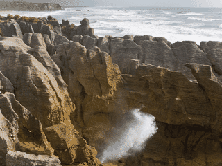
Paparoa National Park offers a rare combination of dramatic coastal scenery and underground wonders on New Zealand's remote West Coast. The park is best known for the Pancake Rocks, where layered limestone formations create striking blowholes that erupt during high tide.
Atlas entry
Paraparaumu and its beachside villages Raumati and Paraparaumu Beach sit on the Kapiti Coast, offering a quieter alternative to Wellington just an hour north. The town serves as the departure point for Kapiti Island, a world-famous nature reserve accessible by ferry.
Atlas entry
Pauanui is an upmarket holiday resort town on the Coromandel Peninsula in Waikato, New Zealand. The town features a white sandy beach beside the Pacific Ocean, a safe harbour, and forest-covered hills, making it ideal for relaxation and outdoor activities.
Atlas entry
Pelorus Bridge is a small locality centred on a historic bridge crossing the Pelorus River on State Highway 6, the main route between Blenheim and Nelson. The surrounding native forest is protected within the Pelorus Bridge Scenic Reserve, making it a natural rest stop with free walks, swimming holes, and a riverside cafe.
Atlas entry
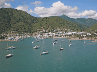
Picton is a small but important town at the top of the South Island, serving as the gateway to the beautiful Marlborough Sounds. For many travellers, it's the gateway to the Marlborough and Nelson Bays regions.
Piha is a small beachside settlement of about 600 residents on Auckland's west coast, famous for its dramatic black iron sand beach and world-class surfing. Lion Rock divides the beach into North and South Piha, creating a striking volcanic outcrop that has become an iconic New Zealand landmark.
Atlas entry
Pleasant Point is significant in aviation history as the site of Richard Pearse's early powered flight experiments. Historical accounts place Pearse's witnessed flights along the Opihi River banks in 1902-1903, predating the Wright Brothers' achievement by approximately six months.
Atlas entry
Port Chalmers is a compact historic port town on the Otago Harbour, serving as the main cargo and cruise ship terminal for Dunedin. The town preserves Victorian-era architecture built from local Port Chalmers bluestone, with several heritage churches and a maritime museum telling the story of early settlers and port life.
Atlas entry
Punakaiki is a tiny settlement on New Zealand's wild West Coast, famous for the Pancake Rocks and Blow Holes at Dolomite Point. The limestone formations look like stacked pancakes, and at high tide with westerly waves, water blasts up to 15m through the blow holes.
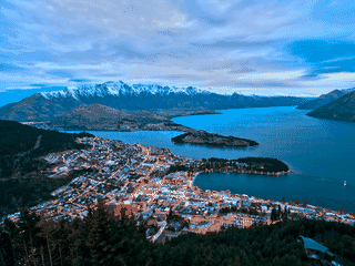
Queenstown is New Zealand's adventure capital, drawing 1.9 million visitors annually to its dramatic Southern Alps setting beside Lake Wakatipu. Originally a ski resort town since the 1980s, it has evolved into a year-round destination where bungy jumping, skydiving, and jet boating compete with vineyard tours, spa retreats, and alpine hiking.
Raetihi is a small Ruapehu District town on New Zealand's central North Island, located 11 km from Ohakune. The town provides budget-friendly accommodation near Tongariro National Park, with impressive views of the three sacred volcanoes: Ruapehu, Tongariro, and Ngauruhoe.
Atlas entry
Raglan is a small seaside town on the west coast of the Waikato region, 45 km from Hamilton, with a population of around 2,700. It is internationally recognized for its world-class surfing, particularly at Manu Bay, and has developed a reputation as an arts hub with a relaxed, bohemian atmosphere.
Atlas entry
Rai Valley is a small rural settlement nestled in lush greenery amid Marlborough's typically dry landscape. Located halfway between Nelson and Blenheim on State Highway 6, it serves as the gateway to the western Marlborough Sounds.
Atlas entry
Ranfurly is a tiny service town in Central Otago's Maniototo plain, famous for its collection of Art Deco buildings dating from the 1930s—including the former Centennial Milk Bar now housing the Art Deco Gallery. The town serves as a convenient stop on the Otago Central Rail Trail, a 150-km cycling and walking track, making it a natural break point between Clyde and Middlemarch.
Atlas entry
Rangiora is the largest town in North Canterbury, serving as a quiet alternative base when exploring the region north of Christchurch. The town grew rapidly after the 2011 Christchurch earthquake as people migrated from the UK and other areas seeking affordable housing.
Atlas entry
Rangitoto Island is a volcanic island in the Hauraki Gulf, just off the North Island of New Zealand. It is 40 minutes by ferry from Auckland and is a popular destination for a half-day hike with great views and tunnel-like caves formed by lava.
Atlas entry
Rawene is the third-oldest European settlement in New Zealand, a quiet harbour town on a peninsula jutting into Hokianga Harbour. It's famous locally as the place where the sun both rises and sets over the water, offering spectacular views from the ferry and shoreline.
Atlas entry
Reefton is a tiny inland town of about 1,000 people beside the Inangahua River, one of the larger settlements on the otherwise sparse West Coast. It is notable for its gold mining and coal mining heritage, and for being the first town in the Southern Hemisphere to have a public electricity supply when its hydroelectric power station opened in 1888.
Atlas entry
Renwick is a small town in the heart of Marlborough's Wairau Valley wine growing district. The town's motto is "The heart of the wine country" and the surrounding land is nearly entirely vineyards.
Atlas entry
Ross is a historic gold-rush town on State Highway 6, best known as the site of New Zealand's largest gold nugget discovery. Visitors come to pan for gold in the same streams where prospectors once struck it rich.
Atlas entry
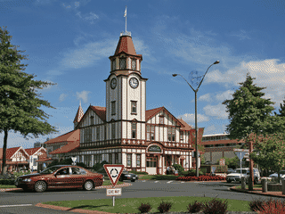
Rotorua is New Zealand's premier geothermal destination, built over a volcanic hot spot in the Taupo Volcanic Zone. The city offers easily accessible hot springs, geysers and mud pools alongside a vibrant Māori culture that is more dominant here than elsewhere in the country.
Russell is a charming historic township at the heart of the Bay of Islands, reachable by a short passenger ferry from Paihia. Once the lawless trading port of Kororāreka, where whalers, merchants, and escaped Australian convicts mixed in the early 1800s, today it offers elegant waterfront dining along The Strand, historic buildings including the country's oldest licensed hotel, and access to scenic Long Beach.
Atlas entry
Seddon is a small Marlborough town near the mouth of the Awatere River, notable for its transition from sheep farming to vineyards. The town is named after Richard John Seddon, Premier of New Zealand from 1893 to 1906.
Atlas entry
Shannon is a small town of 1,600 residents in the Manawatu region of New Zealand's lower North Island. It sits on State Highway 57 between Levin and Palmerston North, making it a practical stopping point for overland travelers.
Atlas entry
Springfield is a tiny Canterbury foothill town of just a few streets, most notable as the last fuel station and garage before the remote Arthur's Pass. It serves as a staging post for travelers heading to the West Coast and Craigieburn ski fields, making it a practical overnight stop rather than a destination in itself.
Atlas entry
St Arnaud is a small lakeside settlement serving as the gateway to Nelson Lakes National Park on New Zealand's South Island. The town, also known as Lake Rotoiti, offers access to spectacular Lake Rotoiti scenery and is the starting point for walks ranging from a few minutes to multi-day treks through the national park.
Atlas entry
Stewart Island (Rakiura) is New Zealand's third-largest island with only 400 residents, offering a rare glimpse of pre-colonial wilderness where kiwi birds roam freely at night. The island sits 30 km south of the South Island across Foveaux Strait, with most visitors arriving by ferry from Bluff.
Stratford is a small Taranaki town best known for its Shakespearean street names—Romeo Street and Juliet Street famously do not intersect. Sitting on the Patea River with panoramic views of Mount Taranaki/Egmont, it serves as a convenient stopover between New Plymouth and Hawera.
Atlas entry
Taipa-Mangonui is a loose chain of seaside communities strung along State Highway 10 on the shores of Doubtless Bay in New Zealand's Far Far North. The area offers a slower pace than busier Northland destinations, with several beaches, historic sites, and a small waterfront town at Mangonui.
Atlas entry
Tairua is a small coastal town on the east coast of the Coromandel Peninsula in New Zealand's North Island. It is a popular destination for summer holidays and serves as a coffee stop for tourists on the Coromandel tourist circuit.
Atlas entry
Takaka is the largest town and hub of Golden Bay in the northwest corner of New Zealand's South Island. Agriculture and tourism are the main industries, making the economy fairly seasonal.
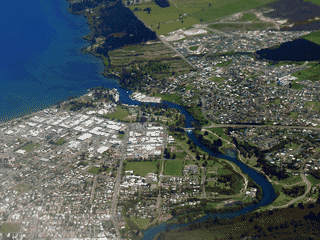
Taupō sits on the northern shore of Lake Taupo, New Zealand's largest lake at 616 km², built around the Waikato River outlet. The town is a base for trout fishing, geothermal attractions, and outdoor activities.
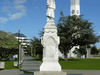
Tauranga is New Zealand's fifth-largest city and the Bay of Plenty's urban hub, known for its sunny, dry climate and waterfront lifestyle. The volcanic cone of Mauao rises at the harbor entrance, topped by a 40-minute summit track offering panoramic views of the coast and harbor.
Atlas entry
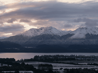
Te Anau is the self-proclaimed walking capital of the world, serving as the gateway to Fiordland National Park and Milford Sound. This small lakeside town offers access to three of New Zealand's Great Walks: the Kepler Track, Routeburn Track, and Milford Track.
Te Awamutu is a small Waikato service town of about 14,000 people, nicknamed the Rose Town of New Zealand for its elaborate rose gardens in the town centre. It serves as a practical stopover on State Highway 3 between Hamilton and Waitomo Caves, offering a taste of New Zealand farming community life without tourist crowds.
Atlas entry
Te Kuiti is a tiny Waikato town of around 4,000 people that bills itself as the Sheep Shearing Capital of the World. Its main claim to fame is the annual Great New Zealand Muster and Running of the Sheep held every April, when sheep from surrounding farms are herded through the main street.
Atlas entry
Te Puke is a small rural town of 9,000 people in New Zealand's Bay of Plenty region, best known as the self-proclaimed 'Kiwifruit capital of the world.' The town sits on fertile volcanic soils with a warm climate, making it ideal for growing kiwifruit, citrus fruits, avocados, and supporting dairy farming. Many travelers pass through for seasonal kiwifruit work, while others use it as a quieter, cheaper base compared to nearby Tauranga or Rotorua.
Atlas entry
Cape Reinga (Te Rerenga Wairua) is the northwesternmost tip of New Zealand's Aupouri Peninsula, 110 km north of Kaitaia. The cape holds deep Māori spiritual significance as the 'leaping-off place of spirits' where, according to tradition, the spirits of the dead descend into the underworld.
Atlas entry
Thames is the gateway town to the Coromandel Peninsula, a historic gold mining settlement that once housed 18,000 people during the 1868 gold rush. The town offers excellent museums documenting its mining and kauri logging heritage, plus access to the magnificent Kauaeranga Valley hiking and camping area.
Atlas entry
Timaru is a city of 28,900 on the South Island's east coast, the second largest in Canterbury region and roughly halfway between Christchurch and Dunedin. Caroline Bay offers a popular sheltered beach and recreation area, making it a quieter alternative to larger New Zealand cities.
Atlas entry
Tiritiri Matangi is one of only two scientific reserves in New Zealand open to the public. This predator-free sanctuary in the Hauraki Gulf has been painstakingly restored by volunteers who planted 250,000–300,000 trees over recent decades.
Atlas entry
Tongariro National Park is New Zealand's oldest national park and a UNESCO World Heritage site, home to three active volcanoes: Mount Ruapehu (the North Island's highest peak at 2,797m), Mount Tongariro, and Mount Ngauruhoe. The park draws hikers for the famous Tongariro Crossing—one of New Zealand's Great Walks—and winter visitors to the island's two main skifields on Ruapehu.
Atlas entry
Torbay is a quiet seaside suburb on Auckland's North Shore, offering a residential atmosphere with few dedicated tourist attractions. Its main appeal is proximity to the beaches of Long Bay and Browns Bay, as well as its own Waiake Beach.
Atlas entry
Turangi is a small town of 3,840 residents (2023) at the southern tip of Lake Taupo in New Zealand's Central North Island. The town exists primarily as a service center for trout fishing on the famed Tongariro River and as a base for visitors heading to Tongariro National Park.
Atlas entry
Twizel is Mackenzie Country's largest town and the primary service hub for visitors heading to Aoraki / Mount Cook National Park. The town emerged as a workers' settlement during hydroelectric power station construction on the Waitaki River, but today tourism drives the local economy.
Atlas entry
Waiheke Island is the third most populous island of New Zealand with 9,800 permanent residents, yet it feels like a world away from Auckland. The island swells dramatically in summer with overseas travelers and New Zealanders seeking escape.
Waihi Beach is a small coastal town in the western Bay of Plenty region of New Zealand, north of Tauranga Harbour and near the base of Coromandel Peninsula. The town offers nine kilometres of sweeping white sand with one of the safest surf breaks in New Zealand.
Atlas entry
Waikanae is a relaxed coastal town of 14,000 residents (2022) on the Kapiti Coast, offering a pleasant blend of retired residents and young families. The town features a lovely long beach and the pristine Waikanae River, making it ideal for visitors seeking outdoor activities away from busier tourist destinations.
Atlas entry
Waipara is a tiny rural settlement in North Canterbury, best known as a boutique wine region specializing in Pinot Noir and Riesling. It serves as a convenient stop along State Highway 1 between Christchurch and Blenheim, with several award-winning wineries within easy reach.
Atlas entry
Waipoua Forest protects some of the last mature kauri trees in New Zealand, including Tane Mahuta at 51m tall—believed to be the largest living kauri. The forest offers a rare opportunity to walk among trees that were ancient when European colonists arrived, with trails ranging from a 200m loop to longer day walks.
Atlas entry
Waipukurau is the largest town in Central Hawke's Bay District with a population of 4,100. Located on the east coast of the North Island, it serves as a rural service center for the surrounding agricultural district.
Atlas entry
Wairoa is a small riverside town of 5,000 people in northern Hawke's Bay, serving as a practical stopover on State Highway 2 between Napier and Gisborne. The town sits on both sides of the Wairoa River, with the main part on the south bank.
Atlas entry
Wakefield is a small, quiet town in the Nelson Bays region of New Zealand's South Island, situated 25 km south-west of Nelson. The town serves as a convenient stop along State Highway 6, making it practical for road trippers traveling between Nelson and destinations south like Greymouth.
Atlas entry
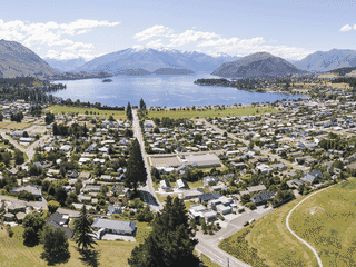
Wanaka shares the mountains, lakes and outdoors appeal of Queenstown but with far smaller crowds and a cooler, more laid-back vibe. It's the gateway to Mount Aspiring National Park and home to half of New Zealand's Olympic skiers and snowboarders.
Ward is a tiny coastal settlement in southern Marlborough named after Sir Joseph George Ward, Premier of New Zealand in the early 20th century. It serves as a quiet stopover on State Highway 1 between Blenheim and Kaikoura.
Atlas entry
Warkworth is a small historic town positioned on the Mahurangi River at its highest navigable point, roughly one hour's drive north of Auckland. It serves as a practical base for exploring the Matakana wine region, Kawau Island, and the Goat Island marine reserve.
Atlas entry
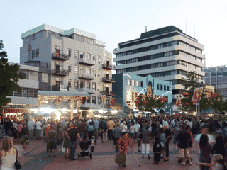
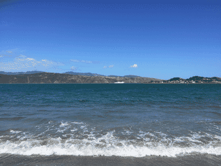
Wellington packs New Zealand's cultural capital into a compact, walkable harborfront where Te Papa museum stands alongside indie boutiques and over 800 cafés—more per capita than New York. The 'Windy City' charms with a vibrant arts scene, craft beer culture along Courtenay Place, and easy access to walking trails ringed by hills.
Westport is the main town of the Buller District with a population of around 4,660, offering spectacular beaches at its back door and the mighty Buller River—the largest river by volume in NZ—running right beside the town. Breathtaking views of the Paparoa Mountains and the Brunner Range provide the backdrop for outdoor adventures including hiking, mountain biking, and beach activities.
Atlas entry
Whakatāne is one of the sunniest towns in New Zealand, making it an appealing base for exploring the eastern Bay of Plenty. The nearby village of Ōhope, just 7 minutes away by car, features one of the country's most awarded beaches with stunning views across to Moutohora (Whale Island).
Atlas entry
Whanganui is one of New Zealand's oldest European settlements, founded in 1840, with a compact city centre filled with heritage architecture and excellent museums. The city sits at the mouth of the Whanganui River, the longest navigable river in the North Island, which is legally recognized as a person under Maori law.
Atlas entry
Whanganui National Park protects 742 square kilometres of pristine wilderness along New Zealand's longest navigable river. The park offers a rare opportunity to experience remote backcountry without technical climbing skills—kayaking the Whanganui River or tramping the Atene Skyline Track provide accessible wilderness immersion.
Atlas entry
Whangarei is the main city of the Northland region with a warm semi-tropical climate, summer daytime temperatures around 24-26°C, and mild winters that rarely have frosts. The city has a population of 57,000 and serves as a gateway to the Bay of Islands and other Northland attractions, offering a slower pace than larger New Zealand cities with access to beaches, waterfalls, and cultural sites.
Atlas entry
Whangaroa is a small harbour town in New Zealand's Far Far North, 40 minutes north of the Bay of Islands along the Twin Coast Discovery Highway. Its main appeal lies in unspoiled natural beauty: the sheltered harbour surrounded by native bush, several pristine white sand beaches, and a legacy of 19th-century shipbuilding that produced over 100 vessels.
Atlas entry
Whataroa is a tiny settlement that punches above its weight for nature lovers. It sits at the foot of the Southern Alps in a glacial valley bounded by the Whataroa River to the north and the Waitangitaona River to the south.
Atlas entry
Whirinaki Te Pua-a-Tāne is one of the world's great prehistoric rainforests, offering a rare glimpse into a Jurassic-era ecosystem. Unlike Northern Hemisphere forests, it is an evergreen world that has never experienced seasonal leaf shedding.
Atlas entry
White Island (Maori: Whakaari, meaning 'The Dramatic Volcano') is the only active marine volcano near New Zealand's main islands. Named by Captain Cook in 1769 when he mistook volcanic steam for a white cloud, it offers a rare glimpse into raw volcanic power.
Atlas entry
Whitianga is the largest town on the east coast of Coromandel Peninsula, serving as a base for exploring Mercury Bay and the Te Whanganui-A-Hei Marine Reserve. The town has a deep-water harbour where cruise boats depart for Cathedral Cove, sea caves, and coastal cliffs.
Atlas entry
In development: the whole atlas offline, a trip planner and a private journal. We'll post here when it ships. No newsletter to join.


_-_Opera_House.jpg)
.JPG)


.jpg)


