Overview
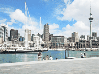
Rangitoto Island is a volcanic island in the Hauraki Gulf, just off the North Island of New Zealand. It is 40 minutes by ferry from Auckland and is a popular destination for a half-day hike with great views and tunnel-like caves formed by lava.
Day Trips · History · Island · Nature · Trekking
Before you go
Accommodation
Only 3 bachs available on Rangitoto—book months ahead. Motutapu's Home Bay Campsite is a backup option with 142 tent sites for $10/adult.
Connectivity
Mobile phone reception is decent on the island, though WiFi is not available.
Packing
Bring a torch/flashlight (smartphone flashlight works) for exploring the lava caves. Comfortable hiking shoes recommended for the summit track.
Transport
Fullers Passenger Ferries is the only ferry service, costing $43 return. Allow 30-45 minutes each way. Miss the last ferry at your own risk—water taxi rescue costs $500.