
Boca Chica
Panama8.22°N 82.22°W
34 places in the index.
8.22°N 82.22°W
9.33°N 82.25°W · 10 m
8.78°N 82.44°W · 1,200 m
9.00°N 79.54°W · 20 m
9.55°N 79.65°W
9.57°N 78.82°W
Aguadulce, meaning 'freshwater' in Spanish, is a small agricultural town in Coclé province located directly on the Pan-American Highway. The town is primarily known for sugarcane cultivation and salt production through evaporated water.
Atlas entry
Altos de Campana National Park is Panama's oldest national park, established to protect critical cloud forest habitat. Located just a 1-hour drive west of Panama City, it offers an accessible escape into nature without extensive travel.
Atlas entry
Balboa sits at the Pacific mouth of the Panama Canal, serving as a quiet counterpoint to bustling Panama City. The town was built by Americans during canal construction and served as the capital of the former Canal Zone until 1999.
Atlas entry
Barro Colorado Island is a pristine tropical jungle island created when the Panama Canal was built in 1913, now sitting in Lake Gatun. The island has been the site of continuous scientific study by the Smithsonian Tropical Research Institute for more than 80 years, making it one of the most researched tropical rainforests in the world.
Atlas entry
Bastimentos is a car-free Caribbean island in Panama's Bocas del Toro province, offering jungle trails, secluded beaches, and a quieter atmosphere than party-focused Bocas town. The island forms part of Isla Bastimentos National Marine Park, protecting mangrove swamps, shallow waters, and four species of nesting sea turtles.
Atlas entry
Boca Brava is a sparsely populated island in the Gulf of Chiriquí, part of the Chiriquí National Marine Park. The island is covered in untouched rainforests and is particularly known for its large population of howler monkeys.
Atlas entry
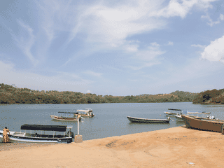
This small fishing village sits beside an estuary on Panama's Pacific coast. Boca Brava lies across the water, with the Gulf of Chiriquí islands drawing travelers onward by boat.
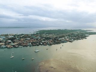
Bocas Town mixes island life with a busy backpacker dining and bar scene. Waterfront nightlife and access to neighboring islands make it a convenient base for exploring the archipelago.
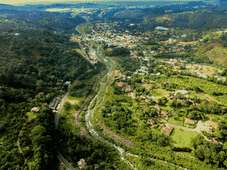
This mountain river town sits in Panama's Chiriquí province. Coffee plantations and geisha coffee give visitors a distinctive reason to explore the surrounding highlands.
Cerro Hoya National Park is one of Panama's most secluded and undeveloped protected areas, featuring pristine coastline along the Azuera peninsula and dense virgin forests on the slopes of an extinct volcano. The park represents the southernmost point of the North American continent, offering hikers and nature lovers a rare opportunity to experience untouched tropical wilderness without the crowds found at more accessible parks.
Atlas entry
Changuinola is a low-key town primarily used as a transit point between Costa Rica and Bocas del Toro. It offers a really interesting vibe, the best and cheapest clothes, and some sweet local restaurants.
Atlas entry
Colón is the Caribbean terminus of the Panama Canal and worth visiting for its raw canal history, Spanish colonial forts, and gritty Caribbean port atmosphere. Despite its notorious crime rate and poor infrastructure, the city offers a unique glimpse into Panama's maritime past and serves as a gateway to the San Blas Islands and Portobelo.
Atlas entry
Darién National Park is the largest national park in Panama and one of the most extensive protected areas in Central America. Its designation as a UNESCO World Heritage Site and Biosphere Reserve reflects its extraordinary biodiversity and cultural significance.
Atlas entry
David is the capital of Chiriqui province in Panama's Pacific West, positioned directly on the Pan American Highway. While not itself a major tourist destination, it serves as a prosperous transport hub with solid infrastructure and good tourist services.
Atlas entry
El Valle de Antón sits inside a volcanic caldera in Cocle province, offering cool mountain air at 2,000 feet elevation. The town is renowned for its biodiversity, with nearby Cerro Gaital National Monument providing habitat for 10,000 plant species, 1,500 trees, 1,000 birds, 220 mammals, and 354 amphibian and reptile species.
Atlas entry
Gamboa sits at the intersection of the Panama Canal and Soberanía National Park, making it a base for birdwatchers, nature photographers, and travelers wanting to escape Panama City's density. The Gamboa Aerial Tram lifts visitors 500 meters above the rainforest canopy, and boat tours on Gatun Lake reveal caimans, monkeys, and osprey nests.
Atlas entry
Isla Bastimentos National Marine Park is one of Panama's first combined land and marine protected areas, established in 1988. The park covers 13,226 hectares of Caribbean coastline, protecting coral reefs, mangrove forests, and virgin beaches.
Atlas entry
Isla Carenero is a small island in Panama's Bocas del Toro archipelago, sitting just across a narrow channel from Bocas Town. It offers a more relaxed atmosphere than its busier neighbor, with wooden shacks on stilts in the southern village, increasingly upscale accommodations along the west side, and beautiful uncrowded beaches along the east shore where most of the surfing happens.
Atlas entry
Isla Palenque is a 400-acre private island in Panama's Gulf of Chiriquí, connected to Boca Brava by a sandy land bridge. The island offers 5 miles of coast with beaches ranging from a 4100-foot crescent beach to intimate private coves under 100 feet long.
Atlas entry
Metropolitan Natural Park is the only national park in Latin America located entirely within a major city, offering a rare opportunity to experience tropical rainforest without leaving Panama City. The park spans 265 hectares and teems with wildlife including mammals, reptiles, and more than 250 species of birds.
Atlas entry
Nueva Gorgona is a small rural black sand beach town in Central Panama, about a one-hour drive from Panama City via the Pan American Highway. It offers a quieter beach experience than more developed coastal areas, with long stretches of sand, basic local restaurants, and expanding condo development.
Atlas entry
This park offers access to pristine cloud forest in central Panama's Coclé province, protecting diverse biodiversity across mountainous terrain. It provides an uncrowded alternative to more popular Panamanian parks, with excellent opportunities for spotting the resplendent quetzal and hiking through lush forest landscapes.
Atlas entry
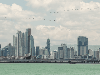
Sleek skyscrapers share the city with historic neighborhoods. As the country's administrative and economic hub, it brings modern urban life alongside a long colonial past.
Pedasí is a quiet Pacific coast town in Los Santos province that draws travelers seeking empty beaches far from Panama's tourist crowds. The surrounding coastline and islands offer birdwatching, fishing, and seasonal whale watching—mother and calf pairs can be spotted from shore.
Atlas entry
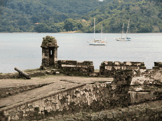
Colonial fortifications give this Caribbean harbor its historic character. Diving and views of cruising yachts add reasons to linger around the bay.
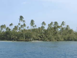
Guna traditions shape daily life across this Caribbean archipelago. Colorful molas and beaded jewelry connect visitors with the islands' living culture.
This Pacific fishing village draws travelers for surfing, diving and access to Coiba National Marine Park. Its low-key atmosphere suits time by the sea and days focused on nature.
Santa Fe is a small mountain town of about 3,200 people close to Santa Fe National Park, just south of the continental divide. There are many hikes located in the area and several hostels and hotels in town that cater to travelers who would like to get away from the hustle and bustle.
Atlas entry
Santa Fe National Park is a vast protected area of over 700,000 hectares of highland forest in Central Panama. Established in 2001, it preserves pristine wilderness with no visitor infrastructure, making it ideal for experienced hikers and birdwatchers seeking solitude.
Atlas entry
Santiago de Veraguas serves as the capital of Veraguas province and a convenient stop along the Pan-American Highway. The city offers a glimpse of provincial Panamanian life away from tourist-heavy areas.
Atlas entry
Soberanía National Park is Panama's premier birdwatching destination, with Pipeline Road ranking among the world's top birding spots. The park protects 19,545 hectares of tropical forest forming part of the Panama Canal's ecological corridor, making it ideal for seeing tropical wildlife including the elusive harpy eagle.
Atlas entry
Taboga is a tranquil island escape just 20 km south of Panama City, offering beaches, mountain hiking, and a charming fishing village atmosphere without the crowds of more commercial destinations. The island maintains strong traditions—many villagers still earn their living through fishing, and local religious festivals like San Pedro, La Virgen del Carmen, and Carnival punctuate the year.
Atlas entry
Volcán is a quiet mountain town of about 10,000 people in Panama's Chiriquí highlands, serving as the gateway to Volcán Barú National Park. The town has a laid-back atmosphere with several hobby farms, local coffee plantations, and more hostels than you might expect for a place of its size.
Atlas entry
Volcan Baru is Panama's only volcano and the country's highest point at 3,475m above sea level, making it a premier trekking destination in Central America. The park covers 14,325 hectares and ranks as the twelfth highest peak in Central America.
Atlas entry
In development: the whole atlas offline, a trip planner and a private journal. We'll post here when it ships. No newsletter to join.


