
Antigua Guatemala
Guatemala14.57°N 90.73°W · 1,582 m
54 places in the index.
14.57°N 90.73°W · 1,582 m
14.93°N 91.12°W · 2,075 m
14.66°N 90.82°W · 1,800 m
15.48°N 90.37°W · 1,320 m
16.93°N 89.88°W · 113 m
14.62°N 90.53°W · 1,500 m
14.70°N 91.20°W · 1,562 m
15.57°N 89.97°W · 390 m
15.83°N 88.75°W · 0 m
14.74°N 91.16°W · 1,597 m
15.73°N 88.60°W · 2 m
14.85°N 91.52°W · 2,433 m
15.66°N 89.00°W
14.70°N 91.28°W
14.72°N 91.27°W · 1,460 m
14.69°N 91.27°W · 1,610 m
14.74°N 91.21°W · 1,832 m
15.53°N 89.96°W
14.77°N 91.18°W · 2,114 m
17.22°N 89.62°W
Aguateca is renowned for its remote, well-preserved Mayan ruins, where visitors can see stelae and temple ruins that have been carefully excavated. The jungle setting means you’re more likely to encounter archaeologists at work than crowds of tourists, offering an authentic archaeological experience.
Atlas entry
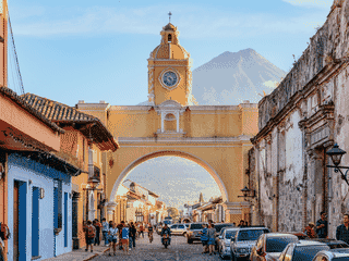
Antigua Guatemala is a UNESCO World Heritage site. The city formerly served as the colonial capital of Central America.
Candelaria Caves National Park contains one of the largest cave systems in Central America, with a total passage length of about 80 km and chambers reaching 60 meters in ceiling height. The park is managed by local Mayan communities, offering an authentic cultural experience alongside geological wonder.
Atlas entry
Cantel is a small K'iche' Maya village perched on a hilltop 10 km from Quetzaltenango, offering a quiet escape into highland indigenous culture. The village centre features a colonial Catholic church and the ruins of the Municipal Palace destroyed in 2002, while the CA2 highway valley below holds much of the commercial activity.
Atlas entry
Ceibal is a small but significant Mayan archaeological site in the remote Northern Lowlands of Guatemala. The site features one temple and numerous stelae—carved stone tablets with relief sculptures depicting Mayan rulers and ceremonies.
Atlas entry
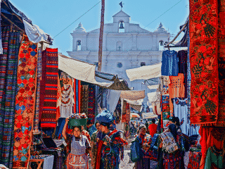
Chichicastenango is a K'iche' Maya town surrounded by highland valleys and mountains. Its Thursday and Sunday market brings handwoven textiles and everyday commerce into the streets around colonial churches.
Chimaltenango is a regional service center on the Pan-American Highway west of Guatemala City. Hotels, restaurants and onward connections make it a practical stop between highland destinations.
Cobán is a highland city with a strong Q'eqchi' Maya cultural presence. Cloud forests and orchids give nature-focused visitors reasons to explore the surrounding area.
Dolores is a small town in south-central Petén that primarily serves as a transit point on the main highway between Guatemala City and Flores. Its main appeal is proximity to unrestored Maya ruins including Ixkún and El Chal, making it a potential stopover for budget travelers heading to Tikal or those interested in less-visited archaeological sites.
Atlas entry
Dos Pilas is a significant Classic Period Mayan archaeological site located in the remote Petén department of Guatemala. The ruins were a major fortified city and ceremonial center with elaborate stelae depicting rulers.
Atlas entry
Atlas entry
El Paredón is a sleepy fishing village on the Pacific Coast of Guatemala that has gained popularity among surfers and backpackers seeking consistent waves and black sand beaches. The village offers excellent surfing conditions, turtle nesting from September to December, and mangrove lagoon exploration.
Atlas entry
Esquipulas is Guatemala's second-most visited destination, drawing an estimated 4-5 million visitors annually to the Basilica of Esquipulas. The colonial church (1735-1759) houses the Cristo Negro (Black Christ), a mystical relic believed to have miraculous healing powers that has attracted celebrity pilgrims including Pope John Paul II and Mother Teresa.
Atlas entry
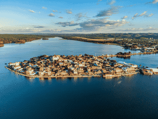
Flores combines red-roofed colonial buildings, cobbled lanes and a historic plaza. It is also a base for trips to Tikal and the wider Petén region.
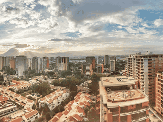
Guatemala City combines modern amenities with historic attractions. Zona 1 brings together the national palace, cathedral and central market.
Huehuetenango (often called Huehue) is the last major Guatemalan city before the Mexican border crossing at La Mesilla, or the first settlement when entering Guatemala from Mexico. While not a tourist destination in its own right, it is a practical frontier town where backpackers stock up on Quetzales cash, medicines from pharmacies, and everyday supplies.
Atlas entry
Jaibalito is reached by boat and footpath. Public lanchas call at a covered dock between Tzununa and Santa Cruz la Laguna.
Jutiapa is a departmental capital in eastern Guatemala, serving as a transit point between Guatemala City and the border with El Salvador. It has little developed tourism infrastructure but offers a genuine, untouristed Guatemalan experience with local markets, affordable accommodations, and access to natural attractions like Lago Guija and the climbable Volcan Ipala.
Atlas entry
Laguna Lachuá is a designated Ramsar wetland and one of Guatemala's more remote national parks, offering a pristine jungle setting around a large crystal-clear lake. Unlike crowded highland destinations, this park provides genuine solitude—perfect for swimmers who want to cool off in deep waters, campers seeking nature immersion, and hikers exploring well-marked trails through tropical forest.
Atlas entry
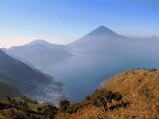
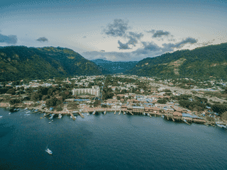
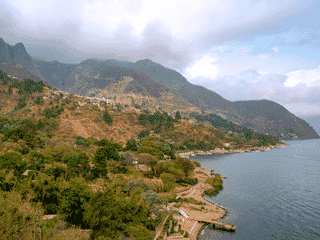
Lake Atitlán fills a volcanic caldera in Guatemala's Western Highlands. Its lakeside towns offer Maya culture, artisan traditions, retreats and backpacker hangouts.
Lanquín is a warm valley base for visiting Semuc Champey. Hostels, caves and river tubing give travelers reasons to linger between onward journeys.
Livingston blends Garifuna, Spanish and Maya cultures on Guatemala's Caribbean coast. Music, coconut-based cooking and nearby waterfalls make it a distinctive stop reached by boat.
The Maya Biosphere Reserve protects rainforest and important Maya archaeological sites. Tikal, Laguna del Tigre and Mirador-Río Azul are among the parks within its boundaries.
Mazatenango serves as a key transit hub in the Pacific Lowlands region, sitting along the CA2 highway that runs the full length of Guatemala's Pacific coast. It is the capital of the Suchitepéquez department and functions as a local commercial center for surrounding agricultural communities.
Atlas entry
Melchor de Mencos is primarily a border crossing point between Guatemala and Belize, but it offers more than just transit. The town has ancient Maya stelae and zoomorphs displayed in a central square, providing a quick cultural stop for travelers.
Atlas entry
Monterrico is Guatemala's most popular beach and the closest Pacific beach to Guatemala City and Antigua. The black volcanic sand is visually stunning but too hot to walk on after 10am, and the 15-25m wide beach stretches for miles along the Pacific.
Atlas entry
Naciones Unidas National Park is the oldest national park in Guatemala, protecting a 2,375-hectare natural forest just 21 km from Guatemala City. The park attracts urban families seeking a weekend retreat with paved walking trails, picnic pavilions, and cultural attractions including a small-scale replica of the Mayan pyramid at Tikal.
Atlas entry
Pacaya Volcano is one of Guatemala's most popular national parks and an active volcano that showed spectacular eruptions for several years. The experience of hiking to volcanic vents where you can roast marshmallows over real magma makes this a unique adventure destination.
Atlas entry
Panajachel is a gateway to Lake Atitlán, with lodging, bars and restaurants around Calle Santander. Public lanchas connect travelers with indigenous villages along the lake.
Piedras Negras is one of the largest and most important Classic Maya cities, located on the eastern bank of the Usumacinta River in northwestern Guatemala. The site is renowned for its extraordinary collection of limestone sculptures, relief panels, and stelae—many of which now reside in museums worldwide.
Atlas entry
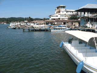
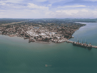
Puerto Barrios is a working port on Guatemala's Caribbean coast. It serves as a gateway to Livingston and the beaches of the Izabal region.
Puerto San José is a Pacific coast city in Guatemala's Pacific Lowlands region with a population of 24,000 (2018). While once the country's most important port until the 1980s, today it serves as a base for the beach resorts of Chulamar and Likín.
Atlas entry
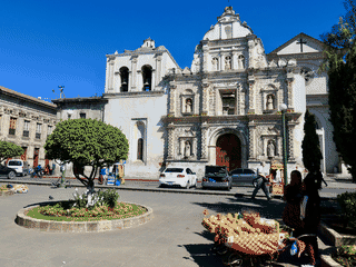
Quetzaltenango sits on a broad highland plain enclosed by hills and volcanoes. The city traces its Maya roots to the K'iche' capital of Xelajú.
Atlas entry
Raxrujá is a small, remote town in Guatemala's Northern Lowlands primarily known as a caving destination. The main attraction is the Candelaria Caves, located in a pleasant garden setting near town.
Atlas entry
Retalhuleu (commonly shortened to Reu) serves as the capital of its department and the main transportation hub for Guatemala's Pacific Lowlands region. The town itself is modest, but its strategic location makes it a practical base for visiting the UNESCO-listed Maya-Olmec ruins at Takalik Abaj, Pacific black-sand beaches at Champerico and Tulate, and a trio of nearby theme parks that have earned the area a reputation as 'Guatemala's Orlando.' For travelers moving between the Western Highlands and Mexico's Chiapas region, Retalhuleu provides straightforward bus connections without the chaos of larger cities.
Atlas entry
Rio Dulce is a river town used as a mooring base by Caribbean sailors. Colonial history, hot springs and tropical scenery make it a useful stop for time on the water.
Riscos de Momostenango National Park protects unusual natural rock formations called hoodoos, carved by wind and rain erosion over millennia. The formations look like church spires or towers reaching up from the ground.
Atlas entry
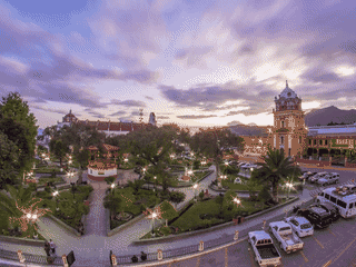
Salcajá is a busy highland town in Guatemala's Western Highlands, famous for its vibrant Maya textile trade and religious heritage. It sits very close to Quetzaltenango, making it an easy addition to a highland itinerary.
Atlas entry
San Andrés is a small Maya Itzá town on the north shore of Lake Petén Itzá, offering a quieter alternative to the busy hub of Santa Elena/Flores. The town is known for its community-based Spanish language schools and home-stay programs, making it ideal for travelers wanting intensive language study in an authentic setting.
Atlas entry
San Antonio Palopo is an authentic Mayan lakeside village with very few tourist trappings. The town is known for its handcrafted ceramics and beautiful but simple native dress (traje).
Atlas entry
San Juan La Laguna is a quieter Lake Atitlán stop with women's textile cooperatives. Natural dyes and Silvestre's surrealist paintings give visitors distinct ways to explore local creativity.
San Marcos La Laguna is a quiet lakeside town associated with yoga, meditation and massage. Traditional Maya clothing and artisan crafts also shape its visitor experience.
San Pedro la Laguna is a compact backpacker town on Lake Atitlán. Its walkable lakeside setting suits an unhurried stay.
San Rafael Pie de la Cuesta is a busy commercial hub serving the surrounding coffee plantations, situated just off the RN1 highway from San Marcos to Malacatan. Located in the bocacosta piedmont region, it offers pleasant temperatures averaging 23°C (74°F), not as hot as the Pacific Lowlands nor as cold as the Highlands.
Atlas entry
Santa Cruz la Laguna invites exploration on foot along trails through gardens and past waterfalls. Lakeshore hotels and restaurants provide places to pause between walks and boat trips.
Santa Lucía Cotzumalguapa (often shortened to just 'Santa') is a hot, busy town in a sugar-producing region of the Pacific plain. The air smells of burnt sugar from the many refineries in the area.
Atlas entry
Santa Maria Nebaj is a small highland town in the Ixil region of Quiché department, Guatemala. The town serves as a gateway to pre-Columbian Mayan archaeological sites and offers excellent hiking through the surrounding ranch country.
Atlas entry
Santiago Atitlán's market street links the docks with a historic Catholic church. Woven textiles and volcanic jade carvings make the walk a natural focus for browsing.
Sayaxché is a small riverside town in Guatemala's Petén department and serves as the primary launching point for visitors exploring Maya ruins in the western part of the region. Most travelers use it as a transit stop between Cobán and Flores, but its strategic location on the Río de la Pasión makes it essential for reaching sites like Aguateca, Ceibal, and Dos Pilas that are inaccessible by road.
Atlas entry
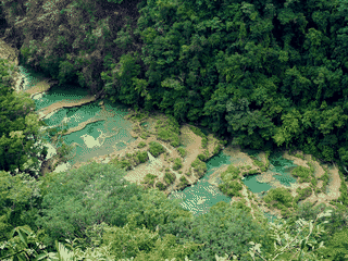
Semuc Champey draws visitors to turquoise swimming pools and a demanding viewpoint trail. Nearby cave passages and river tubing add to the outdoor options.
Sololá is a rewarding stop for traditional textiles and its Sunday flower market. Red-striped women's clothing and black-and-white wool garments for men give the town a distinctive visual identity.
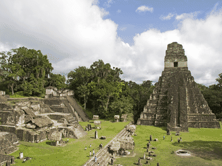
Tikal's Maya temples rise through a jungle canopy, with buildings still awaiting discovery. Wooden stairways on some pyramids lead to views above the trees.
Todos Santos Cuchumatán is one of the last places in Guatemala where both men and women still wear traditional dress, offering a rare glimpse into preserved Mayan culture. The small town of a few thousand people is descended primarily from Mayan ancestry and maintains Mam as the first language alongside Spanish.
Atlas entry
In development: the whole atlas offline, a trip planner and a private journal. We'll post here when it ships. No newsletter to join.


_-_8_(49991937477).jpg)


