_(40860748242).jpg)
Copán Ruinas
Honduras14.83°N 89.15°W
27 places in the index.
14.83°N 89.15°W
14.58°N 88.58°W · 800 m
15.77°N 86.83°W · 3 m
16.38°N 86.40°W
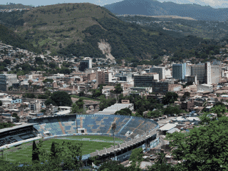
14.08°N 87.22°W · 990 m
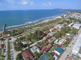
15.78°N 87.47°W · 3 m
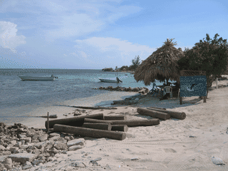
16.10°N 86.93°W · 0 m
Celaque National Park protects the highest peak in Honduras at 2,870 meters on Cerro de las Minas. The park encompasses dense cloud forests, roaring waterfalls, and dramatic mountain landscapes that attract naturalists and adventure hikers.
Atlas entry
Cerro Azul Meámbar National Park (known locally as PANACAM) protects cloud forest in the Sierra Pijol mountain range within the Honduran Central Highlands. The park offers well-developed tourist infrastructure including a paved park road, marked hiking trails, a visitor center, on-site lodging, and a restaurant.
Atlas entry
Comayagua draws tourists with its well-preserved Spanish Colonial architecture and historical significance as the former capital of Honduras. Founded in 1537 by Conquistador Alonso de Cáceres as Santa María de la Nueva Valladolid, the city offers visitors a glimpse into Honduras' colonial past through its 18th-century churches and historic buildings.
Atlas entry
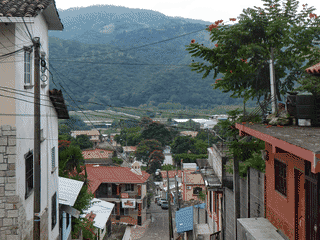
Copán Ruinas is a base for exploring Maya archaeology. The nearby ruins feature a hieroglyphic stairway and carved stone stelae.
Corquin is a small rural town in the Copán department of western Honduras, rarely visited by foreign tourists. The town offers an authentic glimpse of Honduran highland life away from more touristed destinations.
Atlas entry
Cusuco National Park protects 234 km² of the Merendon mountains in the Honduran Highlands. The park offers pristine cloud forest habitats ranging from semi-arid pine forest at lower elevations to unique dwarf forest (bosque enano) above 2,000 metres.
Atlas entry
El Progreso is Honduras' fourth-largest city and an important crossroads in the Valle de Sula agricultural region. Known as the Pearl of the Ulua, it offers a window into authentic Honduran commercial life away from tourist-heavy areas.
Atlas entry
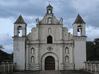
Gracias combines Spanish colonial architecture with nearby hot springs in western Honduras. Churches and the San Cristobal fortress add history to a relaxed small-town stay.
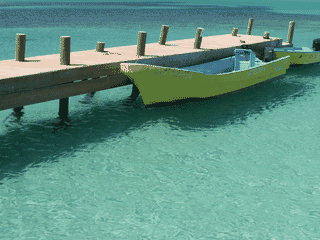
Guanaja is one of Honduras's Bay Islands, about 70 km off the northern coast, with approximately 5,500 residents. The island features the Caracol people—English-speaking descendants of British Caribbean settlers—creating a distinct culture from mainland Honduras.
Atlas entry
Isla del Tigre is a volcanic peak rising sharply from the Gulf of Fonseca, offering a peaceful escape from mainland Honduras. The island attracts upper-class tourists from Tegucigalpa on weekends and holidays, but weekdays are remarkably quiet with few visitors.
Atlas entry
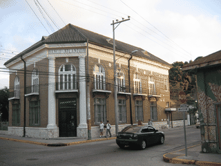
Juticalpa is a commercial hub of the Olancho region with around 140,000 residents. The city has preserved colonial heritage with historical monuments like the Cathedral and City Hall standing alongside some modern structures.
Atlas entry
La Ceiba is a Caribbean-coast base for Pico Bonito, wildlife refuges and Garifuna villages. It also serves as a stop before continuing to the Bay Islands.
La Esperanza sits at 1,700 m elevation, making it the highest and coolest city in Honduras. It serves as the heart of the Ruta Lenca (Lenca Trail), a government-designated cultural tourism corridor spanning Honduras from Santa Rosa de Copán to Choluteca.
Atlas entry
La Tigra National Park is Honduras's most popular park, offering mountainous rainforest hiking just 27 km from Tegucigalpa. The park harbors over 350 bird species, making it ideal for birdwatching, and features seven marked trails ranging from easy 1 km walks to demanding 6.3 km treks that can take 6+ hours.
Atlas entry
Montaña de Comayagua National Park (PANACOMA) protects 18,500 hectares of cloud forest in Honduras's central highlands. The park draws hikers and nature lovers seeking solitude away from tourist crowds—its rivers and streams feed beautiful waterfalls like Cascada de los Ensueños and El Gavilán hidden deep in secondary forest.
Atlas entry
Ocotepeque serves as a practical border crossing point between Honduras and Guatemala, with easy access to Esquipulas in Guatemala and connections to major Honduran cities. The town itself is quiet and not particularly tourist-oriented, but it functions as a useful transit hub for overland travelers moving between these three Central American countries.
Atlas entry
Omoa is a small, picturesque beach town on Honduras's Caribbean coast, formerly the country's main Caribbean port until the mid-19th century. Its main appeal is the relaxed atmosphere, a Spanish colonial fortress, and a calm beach area—all within easy reach of San Pedro Sula.
Atlas entry
Puerto Cortes is the main port of Honduras and the busiest port in Central America, making it a significant transit point for cargo ships and travelers arriving by sea. The city sits on a peninsula between the Caribbean Sea and a lagoon, offering a straightforward stopover between San Pedro Sula and Caribbean coastal destinations.
Atlas entry
Rio Kruta National Park protects over 115,000 hectares of Caribbean wetland on Honduras' remote Miskito Coast. The park shelters sea turtles, manatees, diverse birds, mammals, and reptiles across dense jungle and natural canals.
Atlas entry
The Río Plátano Biosphere Reserve is a UNESCO World Heritage Site protecting one of Central America's last intact tropical rainforests. Remote indigenous communities offer authentic cultural exchanges including drumming, storytelling, and craft making.
Atlas entry
Roatán is a Caribbean island shaped by an ancient coral reef. Scuba diving and snorkeling are central draws.
San Pedro Sula is Honduras's industrial heart. Travelers use it as a transport hub for the country's north.
Santa Rosa de Copán is the largest city in western Honduras and the departmental capital of Copán. It is best known as the home of the Flor de Copán cigar factory, producing some of the world's finest hand-rolled cigars.
Atlas entry
Tegucigalpa spreads across steep hills and winding stone streets. Parks, colonial buildings and churches reward a focused city visit.
Tela pairs palm-lined Caribbean beaches with a slower coastal pace. Garifuna culture gives the town and nearby communities a distinctive identity.
Trujillo offers a rare blend of Caribbean coast beauty and deep colonial history that most tourists overlook. Christopher Columbus first set foot on the American mainland here in 1502, and the city claims the largest pirate gathering in history in 1683.
Atlas entry
Útila combines diving with a lively backpacker social scene. Evening gatherings are part of the island's appeal, particularly during high season.
In development: the whole atlas offline, a trip planner and a private journal. We'll post here when it ships. No newsletter to join.
.jpg)


