Sajama National Park
South America · Bolivia
Did you know?
- Walking routes fan out from the village toward lagoons, hot springs and mountain peaks.
- Parinacota reaches 6,348 m among the park's volcanic climbing objectives.
- The park shelters vicuñas, alpacas and horned coots on the Altiplano.
See also
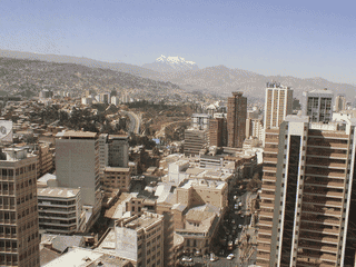

La Paz
Bolivia16.50°S 68.05°W · 3,640 m
Oruro
Bolivia17.97°S 67.12°W · 3,710 m
Copacabana
Bolivia16.17°S 69.08°W · 3,841 m
Quime
Bolivia16.98°S 67.22°W
Overview
Sajama National Park spreads across high Altiplano plains beneath volcanic peaks. Trekkers come for open landscapes, wildlife and quiet walks away from busy tour circuits.
Languages: Aymara, Guaraní, Quechua, Spanish
Why Go
Sajama National Park offers a rare combination of high-altitude trekking, mountain climbing, and meditative solitude on Bolivia's Altiplano. Unlike the 4WD-focused Salt Flats tours, Sajama emphasizes self-guided hiking through vast plains where silence stretches for kilometers, punctuated only by your footsteps. The park shelters exceptional flora and fauna, including vicuñas, alpacas, and rare bird species like horned coots, while providing access to impressive volcano summits including Bolivia's highest peak. With minimal tourist infrastructure and no mandatory guide requirement (unlike Torotoro National Park), it remains one of Bolivia's hidden gems.
Adapted from Wikivoyage contributors · CC BY-SA 4.0
Getting In
Most travelers approach via Patacamaya, taking minibuses or regional vans called servis to Sajama village. Vehicles going to the village depart from the Sajama Junction (Bs. 5) or can be hitchhiked. From Patacamaya, multiple servis options connect throughout the day. The park entrance station is located about 1 km from Sajama Junction and opens at 08:00. From the junction, hikers can walk the 10 km into the village or catch onward transport.
Adapted from Wikivoyage contributors · CC BY-SA 4.0
Fees and Permits
The national park entry fee is Bs. 100 per person. The ticket office is located approximately 1 km from Sajama Junction on the main road and opens daily at 08:00. Hiking within the park is free and does not require a guide, unlike some other Bolivian protected areas.
Adapted from Wikivoyage contributors · CC BY-SA 4.0
When to Go
The dry season from May to October offers the clearest skies and most stable weather for hiking and mountain climbing. Night temperatures drop below 0°C year-round except November through March when they may hover slightly higher. Daytime temperatures range from 15°C to 30°C, with summer months (November-March) reaching the higher end. July and August constitute high season despite the cold nights, as visitors come for clearer conditions and winter mountaineering.
Adapted from Wikivoyage contributors · CC BY-SA 4.0
Getting Around
The park is best explored on foot along established trails. The Sajama village serves as the base for most activities, with trails radiating outward to lagoons, hot springs, and mountain peaks. For the geyser field (9 km from village), taxis cost approximately Bs. 30-40, or hikers can walk the distance. Local servis and informal taxi pickups connect the village to Sajama Junction and nearby points.
Adapted from Wikivoyage contributors · CC BY-SA 4.0
Where to Stay
Accommodations in Sajama village are basic but functional, with mud-style houses offering thick blankets against the cold nights. Hostal Buena Vista (Bs. 40 pp) operated by Carmen and Francisco provides meals (dinner Bs. 20, breakfast Bs. 10-15) and has become popular especially with French travelers—advance booking recommended during high season (July-August). Francisco also offers mountain guide services and equipment rental. Camping is permitted at marked sites along the Tres Lagunas Trail with a proper tent and warm sleeping bag essential for the altitude.
Adapted from Wikivoyage contributors · CC BY-SA 4.0
Food and Drink
Most Sajama accommodations provide lunch and dinner featuring standard Bolivian dishes. Several small local restaurants operate in the village; visitors should walk around to find open options or inquire at their accommodation. Basic supplies and food for self-catering are available at a few small village stores, though selection is limited compared to cities—fresh fruits and vegetables are sparse. Local handicrafts and artesanal clothing can also be purchased in town.
Adapted from Wikivoyage contributors · CC BY-SA 4.0
Things to Do
Sajama offers diverse activities: hot spring and geyser soaking (Termales Donia Theodora Bs. 10 or free), lagoon visits (Laguna Sora Pata, Laguna Huayna Khota, Laguna Isla), and multi-day treks. The Tres Lagunas Trail (41 km, 8-12 hours) passes three lagoons and enters Chilean territory briefly. Accessible peaks include Mt. Quewiña (4,550 m), Mt. Huisalla (5,053 m) with views of Nevado Sajama, and challenging summits Mt. Parinacota (6,348 m, Bs. 1,600 per group) and Nevado Sajama (6,542 m, Bolivia's highest point).
Adapted from Wikivoyage contributors · CC BY-SA 4.0
Safety
The main risks at Sajama are altitude-related: the park sits at extreme elevations (4,550-6,542 m), requiring proper acclimatization before attempting high climbs. Cold weather gear is essential even in summer. The trail into Chile on the Tres Lagunas route spans only 3-5 km before returning to Bolivia—staying on the marked path avoids border complications. Take all rubbish with you; the park's open hiking policy depends on visitors keeping it clean. Hot spring users should test water temperatures carefully as soil near geysers can be dangerously hot.
Adapted from Wikivoyage contributors · CC BY-SA 4.0
Budget Planning
Sajama is extremely budget-friendly. Daily costs break down as: park entry Bs. 100 (one-time), accommodation Bs. 40 pp, meals Bs. 30-35 (breakfast Bs. 10-15 + dinner Bs. 20), local transport Bs. 5-40, hot springs free to Bs. 30. A basic backpacker budget runs approximately Bs. 150-250 per day excluding major climbs. Guided peaks like Mt. Parinacota cost Bs. 1,600 per group.
Adapted from Wikivoyage contributors · CC BY-SA 4.0
Day Trips
From Sajama village, day-trip options include the geyser and hot spring field (9 km walk or Bs. 30-40 by taxi), Laguna Huayna Khota (12 km hike or Bs. 30-40 by taxi), Mt. Quewiña (4,550 m, immediate east of village), and Mt. Huisalla (5,053 m) offering panoramic views. These destinations are accessible in a single day with proper timing, though mountain ascents require early morning starts.
Adapted from Wikivoyage contributors · CC BY-SA 4.0
Go Next
Sajama connects to several regional destinations: Patacamaya (main access point with transport hub), the Salar de Uyuni tours (Sajama offers quieter hiking alternative), San Pedro de Atacama in Chile (accessible via the border crossing near the park), and the broader Oruro department. From Sajama Junction, buses and servis connect to Patacamaya and onward to La Paz or other Altiplano destinations.
Adapted from Wikivoyage contributors · CC BY-SA 4.0
Field guide adapted from Wikivoyage contributors · CC BY-SA 4.0. Text has been adapted and organized for this guide. About our sources.
Places to know
A few starting points from the guide. Check current hours and prices before you go.
- sleep
Hostal Buena Vista
They have mud style houses which are quite comfortable on the inside. The doors do not protect much against the cold, but the blankets are thick. Operated by a nice Bolivian couple, Carmen and Francisco. It gets more and more popular (especially with French), so you might want to call ahead in high season. Also, the offer proper dinner for Bs. 20, and breakfast for Bs. 10-15. Francisco is also a mountain guide offering tours and equipment, but compare prices (.), some travellers were shocked when they learnt about the price.
Recorded price: Bs. 40 pp
Adapted from Wikivoyage contributors
- eat
Village Restaurants
Local eateries serving Bolivian dishes, operated by accommodations or standalone spots—walk around to find open options
Adapted from Wikivoyage contributors
- see
Horned coots (animal)
Laguna Sora Pata offers this rare and protected species of ducks with their surprisingly large nests on the lagoon. Quite picturesque with the snow covered large mountain in the back. If you follow the trek further northeast, shortly after the end of the lagoon you can regularly see large amounts of viscachas.
Adapted from Wikivoyage contributors
- see
Laguna Huayna Khota
A great place to see birds like the Andean avocet, the Andean lapwing, the horned coot, the ruddy duck, the cattle egret, the Puna teal, or the yellow-billed pintail.
Adapted from Wikivoyage contributors
- see
Laguna Isla
Nice and calm waters with lamas feeding in front of the picturesque mountain ranges. Great for some shots with the camera.
Adapted from Wikivoyage contributors
- do
Base Camp Trail (5,680 m)
If you want to hit the height but without a guide, try hiking up to the base camp of Nevado Sajama. In winter, the trail might be impassable with regular boots due to snow and ice, but in summer it is definitely possible. Again, take you time and start the descend early enough—it gets dark at 18:00.
Adapted from Wikivoyage contributors
- do
Cerro Chiar Kkota (5,452 m)
In case you are taking your time with the Tres Lagunas Trail and camp overnight, you might in addition consider this interesting and exciting side-tour with magnificent views of the Lagunas, into the Sajama valley as well as Nevado Sajama itself. Allow for an extra day and night to conquer this mountain, but camping near the Laguna Chiar Kkota is very picturesque and convenient at the same time. In winter, the trail can be impassible.
Adapted from Wikivoyage contributors
- do
Geyser and hot spring field
Surprisingly versatile with hot pools, geysers and mud pools. It also has some little and free and natural pools you can soak in—just select a place in the river that has reasonably much space and is hot enough. But also, check out you map app to find them. The very first pool is already great for a dip. (Control the heat of pool with rock near small waterfall, which blocks the water to the geyser. You can help making the pool bigger & deeper, namely where the water is calm and the hot geysers are. Maybe even bring a shovel, but do not tell the locals about this secret place, or it will be gone soon. Allow for enough cool water to flow by outside of the pool. And watch out, the soil can be very hot.)
Adapted from Wikivoyage contributors
Before you go
Altitude
Park elevations range from 4,200-6,542 m. Acclimatize in La Paz (3,650 m) or elsewhere for 2-3 days before attempting high-altitude hikes and climbs.
Connectivity
Mobile phone coverage is limited or nonexistent in the park. Inform family of plans before entering. No WiFi available in village.
Money
Currency is Boliviano (Bs.). Bring cash—ATMs are not available in Sajama village. Exchange money before arriving or in Patacamaya.
Packing
Bring warm layers, quality sleeping bag (-10°C rating recommended), sun protection, water purification, and sufficient snacks for multi-day treks.
Transport
Get around by foot on trails, hitchhiking, or informal taxi pickups. Servis connect village to Sajama Junction.
Weather
Night temperatures drop below 0°C year-round except November-March. Days range 15-30°C. July-August high season brings cold nights but clearer skies.