Huayna Potosí
South America · Bolivia
Did you know?
- The summit reaches 6,088 m just north of La Paz.
- Rock Camp is reached by a rough trail from Zongo Pass.
- Sheep at base camp and mice at the upper camp can raid unprotected food.
See also
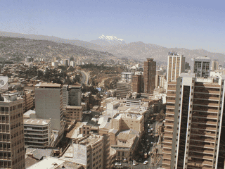

La Paz
Bolivia16.50°S 68.05°W · 3,640 m

Coroico
Bolivia16.18°S 67.73°W · 1,744 m
Sorata
Bolivia15.77°S 68.65°W · 2,700 m
Copacabana
Bolivia16.17°S 69.08°W · 3,841 m
Isla del Sol
Bolivia16.02°S 69.18°W
Quime
Bolivia16.98°S 67.22°W
Overview
Huayna Potosí rises above Zongo Pass, with a route linking base camp, Rock Camp and the summit. Glacier crossings and exposed terrain make this a mountaineering outing.
Languages: Aymara, Guaraní, Quechua, Spanish
Why Go
Huayna Potosí is Bolivia's most-climbed 6000m peak, drawing about 1000 summit-seekers annually. At 6088m, it sits just 30km north of La Paz, making it accessible for travelers based in the capital. The attraction lies in reaching high altitude quickly, crossing glaciers, and watching sunrise from a vantage point above the Cordillera Real—often described as an "easy" peak compared to more technical routes elsewhere in the Andes.
Adapted from Wikivoyage contributors · CC BY-SA 4.0
Getting In
Access is via the road to Zongo, passing through police checkpoints—one at the turnoff to Chacaltaya (Bs. 2 charge), another 5km before Zongo Pass (Bs. 5). Drivers are held about 5 minutes. Most climbers organize through La Paz tour operators; independent climbers drive to Zongo Pass (4700m) where Base Camp sits. Rock Camp at 5130m is reached by continuing the ascent from Base Camp.
Adapted from Wikivoyage contributors · CC BY-SA 4.0
When to Go
Winter (May–October) is the main climbing season—sunny, dry, and more stable. Summers are wet and cloudier. Snow can fall any time, so conditions vary. Pre-dawn summit starts around 01:00 from Rock Camp to reach the top at sunrise. Afternoons (from 16:00 onward) turn bitterly cold as the sun disappears behind the mountain, making the afternoon good for relaxation at Rock Camp between 11:00–16:00 when rocks are heated by sun.
Adapted from Wikivoyage contributors · CC BY-SA 4.0
Getting Around
The route is foot-based: from Zongo Pass Base Camp (4700m) to Rock Camp (5130m) via a rough trail, then to summit. The terrain includes steep scree, glacier crossings, and exposed sections. No public transport reaches the camps—hikers either walk from the road or arrange pickup. The normal climbing route is straightforward on marked paths around crevasses.
Adapted from Wikivoyage contributors · CC BY-SA 4.0
Where to Stay
Three main options exist: Refugio Huayna Potosí at Lake Zongo (Bs. 80/person with meals), free camping at Base Camp (Zongo Pass, 4700m) with unpurified water available, and free camping at Rock Camp (5130m) where previous climbers have leveled tent sites from flat rocks and gravel. Rock Camp is best for summit attempts; Base Camp suits those acclimatizing or doing shorter hikes. Bring all food—mice at Rock Camp, sheep at Base Camp threaten supplies.
Adapted from Wikivoyage contributors · CC BY-SA 4.0
Things to Do
The primary activity is summiting Huayna Potosí via the normal climbing route. Climbers need glacier travel kit (rope, slings, harness, karabiners, crevasse rescue gear), crampons, and an ice axe. The hundreds of annual climbers have worn clear paths around obvious crevasses, though a steep section at ~5600m and the final ascent require rope and rappelling experience. The French Route demands advanced skills and two technical ice axes. Skiing or snowboarding is possible—glacier may be icy on lower sections—but skis in La Paz are poor quality. After 16:00 when cold sets in, making hot chocolate or tomato soup becomes the essential afternoon activity.
Adapted from Wikivoyage contributors · CC BY-SA 4.0
Safety
Altitude and cold are primary dangers: winter nights drop to -15°C or lower at Rock Camp. A warm sleeping bag and good tent are essential. Navigation can fail on descent—remember your exact ascent route, as wrong turns can lead to unexpected rock climbing with a heavy pack. Food must be protected: sheep at Base Camp, mice at Rock Camp will raid supplies if left unsecured. Good boots are crucial for the descent from Rock Camp on loose terrain.
Adapted from Wikivoyage contributors · CC BY-SA 4.0
Go Next
La Paz is the obvious base and next destination—arrange permits, buy/rent gear, and acclimatize there before attempting the climb. Lake Titicaca, the Salt Flats (Salar de Uyuni), and other Bolivian highlands destinations follow naturally from La Paz. Tour operators in La Paz can arrange multi-day packages combining Huayna Potosí with other regional attractions.
Adapted from Wikivoyage contributors · CC BY-SA 4.0
Field guide adapted from Wikivoyage contributors · CC BY-SA 4.0. Text has been adapted and organized for this guide. About our sources.
Places to know
A few starting points from the guide. Check current hours and prices before you go.
- sleep
Base camp
The Altamirano family provides unpurified water and a wooden sign stating the altitude (4700 m). They also sell the odd beer for double the price in La Paz. This is the best place to pitch your tent if not ascending to Rock Camp right away.
Recorded price: camping is free
Adapted from Wikivoyage contributors
- sleep
Refugio Huayna Potosi
offers accommodation, meals. The Altamirano family, +591 71 55 77 37, who runs "base camp" is building a competing refugio, completion and pricing of which is unclear.
Recorded price: Cost of lodging is Bs. 80 per person.
Adapted from Wikivoyage contributors
- sleep
Rock Camp
Previous campers have put great effort into the making of flat spaces, mainly of consisting of flat rocks and gravel. It's a fine place to camp, though sleeping can be a problem because of the altitude and as climbers get up at 01:00 to get to the summit at sunrise. Bring all food from La Paz (Bolivia)
Recorded price: free
Adapted from Wikivoyage contributors
- see
Views from Rock Camp
Panoramic views of neighboring Cordillera Real peaks; sunny 11:00–16:00 is ideal viewing and warming time.
Adapted from Wikivoyage contributors
- do
Normal Route Summit Climb
Standard glacier crossing to 6088m summit; requires glacier kit, crampons, ice axe; pre-dawn start for sunrise.
Adapted from Wikivoyage contributors
- do
Skiing or Snowboarding
Glacier descent possible but lower sections may be icy; skis available in La Paz but poor quality.
Adapted from Wikivoyage contributors
Before you go
Health
Altitude sickness is the main risk at 4700–6088m. Spend time acclimatizing in La Paz first (3600m). Rock Camp sleeping can be difficult due to altitude and early 01:00 wake-ups.
Money
Carry small bills in Bolivianos for police checkpoint fees (Bs. 2–5). Base Camp sells beer at double La Paz prices. ATMs unavailable on mountain.
Packing
Bring all food from La Paz. Required: crampons, ice axe, glacier gear, warm sleeping bag, sturdy boots, sunglasses, sunscreen, and headlamp for pre-dawn summit push.
Safety
Winter nights reach -15°C. Bring warm sleeping bag, good tent, and navigation skills—routes are hard to follow descending. Secure food from sheep and mice.
Transport
No public transport to camps. Drive or hire to Zongo Pass. Police checkpoints at Chacaltaya turnoff and before Zongo Pass require brief stops.
Weather
Winter (May–Oct) is prime climbing season—dry and sunny. Snow possible year-round. Afternoon sun (11:00–16:00) warms Rock Camp; cold returns by 16:00.