Overview
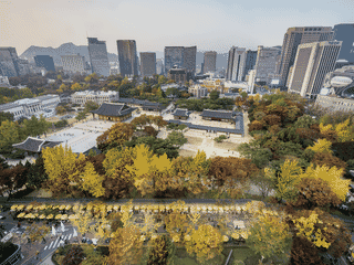
Dongducheon is a satellite city 40 km north of Seoul, best known for Soyosan Mountain with well-maintained hiking trails and Tapdong Valley, one of the most beautiful vacation spots in Gyeonggi province. The city grew as a US military base village since the Korean War, and hosts the longest-running rock festival in South Korea, founded in 1999.
Budget Travel · Festivals · History · Nature · Trekking
Before you go
Connectivity
South Korea has excellent mobile coverage. Major carriers (KT, SKT, LG U+) offer SIM cards and eSIM options at airports and convenience stores. Free WiFi available at subway stations and some cafes.
Language
Korean is the local language. English signage is limited outside major tourist sites. Basic Korean phrases helpful for local buses and smaller establishments.
Money
South Korean won (KRW) is the local currency. Most establishments accept cash and cards. ATM availability is good at subway stations and bank branches throughout the city.
Safety
Dongducheon is generally safe with low crime rates. Standard urban precautions apply. Military areas exist near US camp perimeters—observe posted restrictions.
Transport
Subway Line 1 connects Dongducheon to Seoul in 1-1.5 hours. Five stations serve the city from north to south. Local buses run infrequently—check Gyeonggi Bus Information App or website before traveling.
Weather
Continental climate with average annual temperature 12°C. Winters are cold (January average -2.4°C) with significant snowfall. Summers hot and humid (August average 28°C). Annual precipitation 1,028 mm with heaviest rainfall July-August.