Overview
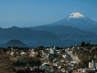
Cofre de Perote National Park surrounds Mexico's 8th highest mountain at 4,282 meters, offering rugged trails through pine forests with outstanding views of neighboring volcanoes including Pico de Orizaba. The park is particularly popular for mountain biking with dedicated routes like El Lince and Ruta del Cofre, plus classic hiking trails that reach the summit.
Nature · Trekking
Before you go
Money
No park fee is charged. Bring cash for the Miscelanea Lizbeth store in El Conejo for last-minute supplies before entering the park.
Packing
Bring all food and water as nothing is available inside the park. Layers are essential for the temperature drop at 4,000+ meter elevation.
Safety
Standard mountain safety applies. No emergency services exist in the backcountry; carry basic first aid and a communication device.
Transport
Rent a car in Puebla or take a taxi from Perote to reach the park. The trailhead is at El Conejo village, 20 km from Perote.