Carrasco National Park
South America · Bolivia
Did you know?
- Inca Chaca combines waterfalls with a rock formation called Devil's Window.
- Oilbirds nest beside bats in the Cavernas del Repechón sanctuary.
- Pools and rapids fill the Cajones del Ichilo river canyon.
See also
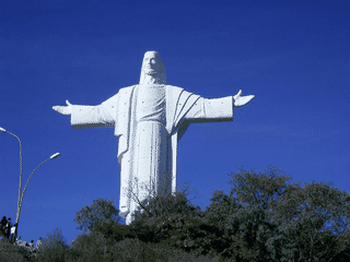

Cochabamba
Bolivia17.38°S 66.17°W · 2,558 m


Sucre
Bolivia19.03°S 65.26°W · 2,810 m
Tarata
Bolivia17.61°S 66.02°W · 2,766 m
Torotoro National Park
Bolivia18.10°S 65.77°W · 2,542 m
Quillacollo
Bolivia17.40°S 66.28°W · 2,425 m
Samaipata
Bolivia18.18°S 63.88°W · 1,670 m
Overview
Carrasco National Park combines cloud forests, deep valleys and waterfalls. Remote hiking routes and birdlife give visitors a reason to explore beyond the road.
Languages: Aymara, Guaraní, Quechua, Spanish
Why go?
Carrasco National Park (Parque nacional Carrasco) is Bolivia's largest protected natural area, covering 622,600 hectares in the Cochabamba Department. The park offers diverse ecosystems including cloud forests, deep valleys, waterfalls, and unique rock formations. Visitors come for wildlife spotting (spectacled bears, oilbirds, endemic birds), dramatic landscapes, and challenging hiking trails through remote wilderness.
Adapted from Wikivoyage contributors · CC BY-SA 4.0
Getting in
Most visitors access the park from either Cochabamba or Santa Cruz. The park is large with multiple entry points depending on which attractions you plan to visit. Private transportation or organized tours are the most practical options for reaching the base areas and trailheads.
Adapted from Wikivoyage contributors · CC BY-SA 4.0
Fees and permits
The park entrance is open from sunrise to sunset. Park admission costs about Bs. 50. The park office can provide maps and information about camping or hiking trails. Some areas of the park may be inaccessible during the rainy season.
Adapted from Wikivoyage contributors · CC BY-SA 4.0
Get around
A 4WD truck is advisable during the rainy season, when roads become slick and muddy. The park's remote attractions require vehicle transport, and trails vary from well-marked paths to challenging backcountry routes.
Adapted from Wikivoyage contributors · CC BY-SA 4.0
When to go
The park may have limited access during the rainy season when trails become flooded and roads turn to mud. The dry season offers more reliable access for hiking and wildlife viewing.
Adapted from Wikivoyage contributors · CC BY-SA 4.0
Things to do
The park features multiple named attractions: Cavernas del Repechón Wildlife Sanctuary where oilbirds (Guacharo) nest alongside bats; Inca Chaca (Inca Bridge) with its dramatic waterfalls and Devil's Window rock formation; Sehuencas Valley where spectacled bears (jukumari) are commonly spotted; Quewiñas Forest with its 3.2-km trail through endemic forest taking about 5 hours round trip; Cajones del Ichilo river canyon with pools and rapids; and Valle de la Luna with bizarre rock formations popular for spotting parrots and parakeets.
Adapted from Wikivoyage contributors · CC BY-SA 4.0
Go next
From Carrasco, continue to nearby protected areas including Torotoro National Park with its dinosaur footprints and cave paintings, Amboró National Park with its cloud forest biodiversity, the colonial town of Tarata, or Villa Tunari as a gateway to other Cochabamba attractions.
Adapted from Wikivoyage contributors · CC BY-SA 4.0
Field guide adapted from Wikivoyage contributors · CC BY-SA 4.0. Text has been adapted and organized for this guide. About our sources.
Places to know
A few starting points from the guide. Check current hours and prices before you go.
- see
Cajones del Ichilo
Winding river stretch through canyons with rapids, offering pools and fishing holes for visitors.
Adapted from Wikivoyage contributors
- see
Cavernas del Repechón Wildlife Sanctuary
Underground sanctuary where oilbirds (Guachero) nest alongside various bat species in dramatic caverns.
Adapted from Wikivoyage contributors
- see
Inca Chaca (Inca Bridge)
Natural bridge with gorgeous waterfalls plus quirky attractions like Ventana del Diablo (Devil's Window) rock formation.
Adapted from Wikivoyage contributors
- see
Quewiñas Forest – Infiernillos
Dense forest of Kewines trees (guardians of water) with a 3.2-km trail through endemic bird and plant habitat, taking about 5 hours round trip.
Adapted from Wikivoyage contributors
- see
Sehuencas Valley
Scenic cloud-forest valley where visitors have good chances of spotting spectacled bears (jukumari, mountain bear, or uku-uku).
Adapted from Wikivoyage contributors
- see
Valle de la Luna
Bizarre rock formations scattered across a pitted rocky surface, popular for spotting parrots and parakeets.
Adapted from Wikivoyage contributors
Before you go
Money
Park admission is approximately Bs. 50 (Bolivianos). Budget for fuel and potential guide costs.
Safety
Remote park with limited infrastructure. Travel with adequate supplies, communication devices, and ideally a local guide for backcountry areas.
Transport
Access via Cochabamba or Santa Cruz. A 4WD vehicle is essential during rainy season due to muddy roads.
Weather
Some areas inaccessible during rainy season. Dry season preferred for reliable trail access.