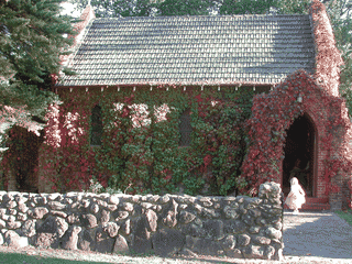

Uralla
Oceania · Australia
See also
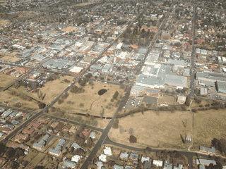

Armidale
Australia30.50°S 151.65°E · 980 m
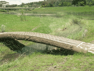

Walcha
Australia30.98°S 151.60°E · 1,047 m
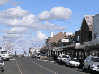
.JPG)
Guyra
Australia30.22°S 151.67°E · 1,336 m
.JPG)
Bundarra
Australia30.17°S 151.07°E · 661 m

Tamworth, New South Wales
Australia31.08°S 150.92°E · 404 m
Overview
Uralla is a small New England town (population 2,743) at the junction of the New England Highway and Thunderbolts Way. The town is steeped in bushranger history, being the territory of Captain Thunderbolt (Frederick Ward), whose statue stands near the Visitor Information Centre.
Languages: English
Why Go?
Uralla is a small New England town (population 2,743) at the junction of the New England Highway and Thunderbolts Way. The town is steeped in bushranger history, being the territory of Captain Thunderbolt (Frederick Ward), whose statue stands near the Visitor Information Centre. It serves as a practical stopover between larger centres like Armidale and Tamworth, with walking trails, gold fossicking opportunities, and access to Oxley Wild Rivers National Park.
Adapted from Wikivoyage contributors · CC BY-SA 4.0
Understand
The name Uralla comes from the language of the indigenous Aniwan people and means 'a ceremonial meeting place and look out on a hill', in reference to Mount Mutton on the town's outskirts. The first European settlers established themselves on the site in 1841, followed by a gold rush in 1852. Captain Thunderbolt operated throughout the district and is buried in the Pioneer Cemetery. Uralla is the main centre of the Uralla Shire Local Government area.
Adapted from Wikivoyage contributors · CC BY-SA 4.0
Get In
Uralla sits at the junction of the New England Highway (A15) and Thunderbolts Way (Route 19). NSW TrainLink regional services connect through Uralla Railway Station on the North Western line, though there is no ticket office on-site—reservations must be made by phone or online. The nearest major train station is Armidale Railway Station (59 km north), with services to Sydney via the North Western line. Armidale also has an airport with connections. Driving from Sydney takes approximately 5-6 hours via the New England Highway.
Adapted from Wikivoyage contributors · CC BY-SA 4.0
Getting Around
Uralla is best explored on foot or by car. The town is compact with most attractions, shops, and eateries along Bridge Street. The Uralla Heritage Walk is a 1-2 hour self-guided tour covering over 50 historical buildings—pick up a map from the Visitor Information Centre. The Mount Mutton Walking Trail starts at the Soldiers Memorial in Alma Park and takes 30-45 minutes, with views from Uralla Lookout. A car is essential for reaching outlying attractions like Dangars Falls (36.5 km), Mount Yarrowyck Nature Reserve (27.5 km), and the Woolridge Fossicking Reserve (7 km).
Adapted from Wikivoyage contributors · CC BY-SA 4.0
When to Go
The New England region experiences four distinct seasons. Spring (September-November) brings wildflowers to Alma Park and is ideal for walking trails, with milder temperatures ranging from 10-22°C. Autumn (March-May) offers spectacular fall foliage along the highway and is considered by many the best time to visit. Summer (December-February) can be hot (up to 30°C) but is when the Uralla Show is held in February. Winter brings colder nights and occasional frost but fewer crowds. Dangars Falls is an ephemeral waterfall that flows best after rain—typically in spring and summer.
Adapted from Wikivoyage contributors · CC BY-SA 4.0
Where to Stay
Uralla offers accommodation options from budget caravan parks to heritage motels. The Country Road Caravan Park (opposite The Big Soldier statue) and Queen Street Uralla Caravan Park (next to Alma Park) cater to campers and caravans, with powered sites from around $30/night. Historic pubs like Coachwood and Cedar Hotel Motel (The Top Pub) and Thunderbolt Inn Hotel (The Bottom Pub) offer pub-style accommodation on Bridge Street. For something more private, Grace Cottages offers self-contained cabins 3 km west of town from $220/night with minimum 2-night stay. Dingle B&B provides historic cottage accommodation with breakfast included.
Adapted from Wikivoyage contributors · CC BY-SA 4.0
Food and Drink
Bridge Street is the main dining strip with options for every budget. For quick bites, The Pie Mechanic serves craft pies (Tu-Su 7AM-4PM) and Michael's Cafe offers breakfast and lunch with Indian cuisine. Fung Wah Asian Restaurant provides Chinese Australian fare, while West Ranges Bistro at the Uralla Bowling Club offers Chinese Australian cuisine Tu-Su. The pub hotels—The Top Pub and Bottom Pub—both serve hearty pub meals. For drinks, the New England Brewing Co. (19 Bridge Street) crafts preservative-free, unfiltered beer and offers tastings W-Sa. Sunhill Dairy Goats (9.5 km southeast) offers goat cheese and farm experiences by appointment.
Adapted from Wikivoyage contributors · CC BY-SA 4.0
Things to Do
History enthusiasts will appreciate the Thunderbolt Trail—the statue near the Visitor Information Centre, Thunderbolt's Rock (7.5 km south on the highway), and his grave in the Pioneer Cemetery. McCrossin's Mill Museum presents exhibits on the Aniwan people, Captain Thunderbolt, the gold rush, and Australia's first world sporting champion (Adults $7). For nature, Dangars Falls (36.5 km drive plus walking track) offers a 183m ephemeral waterfall with a 6km walking track. The Woolridge Fossicking Reserve (7 km northeast) allows gold panning and gemstone hunting. Closer to town, explore Dangars Lagoon and Racecourse Lagoon (4-5 km south) for birdwatching from mid-spring to mid-autumn.
Adapted from Wikivoyage contributors · CC BY-SA 4.0
Safety
Uralla is a small, generally safe town. Standard precautions apply—secure valuables in vehicles and accommodation. Emergency services are limited in Uralla; the nearest hospital with 24-hour emergency department is in Armidale (23.5 km, 20 minutes drive). In case of emergency, phone 000. Road safety is important on the New England Highway—watch for wildlife, particularly at dawn and dusk. Some walking trails, like the Mount Mutton descent, are steep and not wheelchair accessible.
Adapted from Wikivoyage contributors · CC BY-SA 4.0
Connectivity
Uralla is covered by Telstra, Optus, and Vodafone with minimum 4G coverage. The Uralla Visitor Information Centre, Altona Motel, Grace Cottages, and Queen Street Caravan Park offer free WiFi to visitors. Most cafes and pubs on Bridge Street also have WiFi available for customers. Power outlets follow Australian standards (Type I, 230V/50Hz).
Adapted from Wikivoyage contributors · CC BY-SA 4.0
Budget Planning
Uralla is an affordable New England stopover. Caravan parks offer powered sites from $30/night, making this one of the cheapest accommodation options. The Uralla Swimming Pool charges Adults $3.60, Children $2.10 for a day swim. Basic meals like pies, takeaways, and cafe fare range from $5-15 per person. Gold fossicking at Woolridge Reserve is free (bring your own equipment). McCrossin's Mill Museum admission is Adults $7, Concession $5, Children $3. A budget backpacker could manage on $50-70 AUD/day staying at caravan parks and self-catering.
Adapted from Wikivoyage contributors · CC BY-SA 4.0
Day Trips
Uralla's position at a highway junction makes it a good base for exploring the Southern New England region. Armidale (23.5 km, 20 minutes) offers larger shops, the Armidale Hospital, and the Bicentennial Arboretum. Dangars Falls in Oxley Wild Rivers National Park (36.5 km one-way) is a full morning or afternoon trip. Mount Yarrowyck Nature Reserve (27.5 km northwest) features Aboriginal cave paintings on a 3 km walking track. Walcha (41 km southeast, 28 minutes) is accessible via Thunderbolts Way. The historic Gostwyck Chapel (11.5 km east) and octagonal Deeargee Woolshed (11.7 km east) are best seen in autumn when the tree-lined avenue is at its most spectacular.
Adapted from Wikivoyage contributors · CC BY-SA 4.0
Go Next
From Uralla, the New England Highway (A15) runs northeast to Armidale (23.5 km) and northeast through Guyra (59 km) to Glen Innes (120 km) and Stanthorpe. Southwest along the same highway leads through Bendemeer (28 km) to Tamworth (88.5 km, 1 hour 3 min)—Australia's country music capital. Thunderbolts Way (Route 19) heads northwest to Bundarra (72.5 km, 49 minutes), Bingara (145 km), and Inverell (119 km). Southeast via Duke Street leads to Walcha (41 km, 28 minutes) and connections to the NSW North Coast. NSW TrainLink services connect to Sydney via Armidale or via Moree/Tamworth.
Adapted from Wikivoyage contributors · CC BY-SA 4.0
Field guide adapted from Wikivoyage contributors · CC BY-SA 4.0. Text has been adapted and organized for this guide. About our sources.
Places to know
A few starting points from the guide. Check current hours and prices before you go.
- eat
Coachwood and Cedar Hotel Motel
Pub fare.
Adapted from Wikivoyage contributors
- eat
Fung Wah Asian Restaurant
Chinese Australian cuisine.
Adapted from Wikivoyage contributors
- eat
Michael's Cafe and Catering
Cafe with Indian and other cuisine. Only pick up or $5 delivery in Uralla while Covid-19 restrictions in place.
Adapted from Wikivoyage contributors
- eat
Subway
Adapted from Wikivoyage contributors
- eat
The Alternative Root
Cafe fare.
Adapted from Wikivoyage contributors
- eat
The Pie Mechanic
Craft pies, patisserie, coffee.
Adapted from Wikivoyage contributors
- eat
Thunderbolt Country Kitchen
Cafe fare.
Adapted from Wikivoyage contributors
- eat
Thunderbolt Inn Hotel
Pub fare.
Adapted from Wikivoyage contributors
Before you go
Accommodation
Budget options include Queen Street Caravan Park (powered sites from $30/night) and Country Road Caravan Park. Historic pubs on Bridge Street offer affordable pub accommodation.
Connectivity
Telstra, Optus, and Vodafone all provide 4G coverage in Uralla. Free WiFi available at the Visitor Information Centre, Altona Motel, Grace Cottages, and Queen Street Caravan Park.
Emergency
No hospital in Uralla—the nearest 24-hour emergency department is at Armidale Hospital (226 Rusden Street), 23.5 km away. Phone 000 for emergencies.
Food
The Pie Mechanic serves craft pies, Michael's Cafe offers Indian cuisine, and Fung Wah provides Chinese Australian food. Pubs serve hearty meals. New England Brewing Co. offers local craft beer tastings.
Money
ATMs available at National Australia Bank (35 Bridge Street), Regional Australia Bank (50 Bridge Street), and at The Top Pub. Bank@Post at Australia Post (11 Hill Street) offers banking services for multiple banks.
Transport
Uralla sits at the junction of the New England Highway (A15) and Thunderbolts Way (19). NSW TrainLink stops at Uralla Railway Station but has no ticket office—book online or by phone.