Overview
Santo Antão is the most northern and western island of Cape Verde, a dramatic volcanic landscape that surprises visitors who arrive expecting barren terrain. Within half an hour of the ferry port, steep winding roads climb into pine forests and skirt volcano edges, revealing a lush, green island unlike the other archipelago members.
Beach · Day Trips · Diving · Island · Nature
Before you go
Activities
Hiking is the main draw: four major trail systems in the north plus coastal routes. Scuba diving and snorkeling available at Tarrafal.
Food
Grogue (sugar cane rum) is the local specialty, best purchased directly from distilleries March-May. Fresh fish and grouper are highlights.
Money
Currency is Cape Verdean Escudo (CVE). Credit card acceptance is limited outside major towns; carry cash for smaller establishments.
Transport
Ferry from Mindelo (São Vicente) takes about 1 hour. Aluguers (shared taxis) connect towns; download offline maps before arrival.
Weather
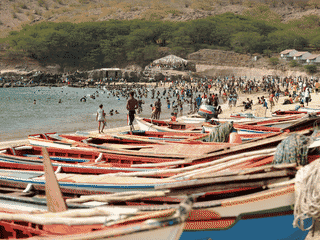
Northeast trade winds blow most of the year, making most beaches dangerous. Tarrafal de Monte Trigo is sheltered and swimmable nearly year-round.