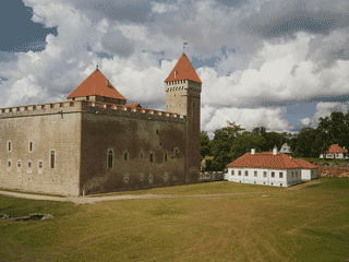

Saaremaa
Eastern Europe and the Balkans · Estonia
Did you know?
- Papissaari Harbour is a seasonal stop for smoked flatfish.
- A meteorite crater holds Kaali's Holy Lake.
- Angla's windmills stand beside the Upa–Leisi road.
See also
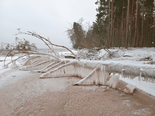

Hiiumaa
Estonia58.90°N 22.58°E
Overview
Saaremaa mixes juniper-dotted landscapes with windmills, medieval stone churches and quiet coastal villages. Stone fences and thatched roofs give its rural settlements a distinctive character.
Languages: Estonian
Why go?
Saaremaa is Estonia's largest island in the Baltic Sea, retaining its uniqueness through centuries of German, Danish, Swedish, and Russian rule. The island features juniper-dotted alvars, historic windmills, medieval stone churches, and quiet coastal villages with stone fences and thatched-roof houses. Dolomite landscapes and local home-brewed beer are cultural symbols, while Saaremaa waltz and a distinct island humor (especially jokes about Hiiumaa neighbors) define local identity. Summer brings opera performances and active café culture; spring and autumn suit nature walks and bird watching.
Adapted from Wikivoyage contributors · CC BY-SA 4.0
Getting in
Access via mainland port at Virtsu with ferry to Kuivastu on Muhu island, then causeway to Saaremaa. Long-distance buses connect major Estonian cities with Kuressaare; frequency varies by season. Small airport in Kuressaare handles seasonal domestic flights. Vehicle ferry information available at praamid.ee.
Adapted from Wikivoyage contributors · CC BY-SA 4.0
Getting around
Distances are moderate; a car or bicycle offers flexibility for remote nature spots. Local buses link towns and larger villages with sparse schedules outside peak season. Roads generally in good condition; minor roads can be narrow. Peatus.ee route planner provides public transport information.
Adapted from Wikivoyage contributors · CC BY-SA 4.0
When to go
Summer (June-August) is busiest season with more transport frequency, active café scene, and Saaremaa Opera Days in July. Spring and autumn are calmer, good for nature walks and bird watching at Vilsandi National Park. Winter has limited transport; Hiiumaa can be reached via ice bridge. Ticks present in warmer months—use repellent and check after hikes.
Adapted from Wikivoyage contributors · CC BY-SA 4.0
Where to stay
Accommodation ranges from holiday homes to camping. Kuus Tuba in Leisi offers singles from €15; Kooli Kopli Holiday Homes in Mustjala from €13; Pidula Forell from €10. Karujärve Camping near Kärla has cabins and outdoor café with water bicycles. Loona Manor within Vilsandi National Park offers hotel, tenting area, and restaurant. Summer booking recommended during busiest weeks.
Adapted from Wikivoyage contributors · CC BY-SA 4.0
Food and drink
Local cuisine centers on fish, potatoes, rye bread, and garden herbs. Smoked fish and seasonal preserves available at farm-gate sales with prior notice. In summer, cafés appear across the island; booking helps during busiest weeks. Craft beer and cider widely available; non-alcoholic options common in cafés. Papissaari Harbour offers smoked flat fish during season.
Adapted from Wikivoyage contributors · CC BY-SA 4.0
Things to do
Key attractions include Kaali meteorite craters (7500-7600 years old, Holy Lake) 18 km from Kuressaare; Angla Windmills at 32-km mark on Upa-Leisi road; medieval Karja Church (smallest in Saaremaa, famous for Romanesque to High Gothic stone sculptures); Kihelkonna Church with Estonia's oldest Renaissance altarpiece (1591) and 60 m neogothic tower with views; Panga cliff (21.3 m, highest on Saaremaa and Muhu); Asva Bronze-Age fortified settlement at 33-km mark on Kuivastu-Kuressaare road. Nature activities include Koigi Bog Study Trail (4.8-5.7 km around Pikkjärv), bird watching at Vilsandi National Park, and water bicycle rental at Karujärv.
Adapted from Wikivoyage contributors · CC BY-SA 4.0
Safety
Check weather conditions near cliffs and exposed coasts, especially during storms. Stay on marked trails in bogs and nature reserves. Ticks present in warmer months—use repellent and check after hikes. Boardwalks in bogs must be followed; no open fires permitted in protected areas.
Adapted from Wikivoyage contributors · CC BY-SA 4.0
Connectivity
Mobile coverage generally good but may weaken in sparsely populated areas. Public Wi-Fi common in Kuressaare and larger accommodations. EU standard power plugs (Type F, 230V).
Adapted from Wikivoyage contributors · CC BY-SA 4.0
Budget
Backpacker daily costs on Saaremaa run moderate by Estonian standards. Accommodation ranges from €10-15 for budget options. Meals at local cafés cost €8-15. Local bus transport affordable; car rental adds flexibility for remote sites. Saaremaa Opera Days in July attract cultural visitors. Budget for ferry crossing (approximately €12-20 per vehicle depending on size).
Adapted from Wikivoyage contributors · CC BY-SA 4.0
Day trips
Vilsandi National Park: second oldest nature reserve in Europe (1910), with Silurian cliffs, fossils, 36 wild orchid species, grey seals, and over 250 bird species. Boats depart from Papissaari Harbour. Koguva village on Muhu island is Estonia's best preserved village. Sõrve peninsula offers coastal exploration and Jämaja church at 21-km mark on Kaugatuma-Sääre road. Loode Oak Forest near Kaarma with rare orchids and bird watching platform.
Adapted from Wikivoyage contributors · CC BY-SA 4.0
Etiquette
Follow local guidance in protected areas: no open fires, camp only where allowed, keep to boardwalks in bogs. Leave gates and fences as found and carry out rubbish. In villages, respect the quiet rural atmosphere and thatched-roof heritage. Historic churches request modest dress and quiet behavior.
Adapted from Wikivoyage contributors · CC BY-SA 4.0
Go next
Hiiumaa: Estonia's second largest island, known for lighthouses, ancient churches, and distinct humor—reachable by ice bridge in winter. Muhu: third largest island connected by embankment to Saaremaa, with open air museum, fishing villages, working windmills, and thatched cottages. Pärnu: Estonia's fourth largest city, summer capital with balneo-therapy complexes and spa centers. Vilsandi National Park: marine fauna, international bird sanctuary on Saaremaa's west coast.
Adapted from Wikivoyage contributors · CC BY-SA 4.0
Field guide adapted from Wikivoyage contributors · CC BY-SA 4.0. Text has been adapted and organized for this guide. About our sources.
Places to know
A few starting points from the guide. Check current hours and prices before you go.
- sleep
Kooli Kopli Holiday Homes
Recorded price: From €13
Adapted from Wikivoyage contributors
- sleep
Kuus Tuba
Recorded price: Single from €15
Adapted from Wikivoyage contributors
- sleep
Pidula Forell
Recorded price: From €10
Adapted from Wikivoyage contributors
- see
Angla Windmills
The only remaining group of windmills on Saaremaa is in the village of Angla.
Adapted from Wikivoyage contributors
- see
Asva Fortified Settlement
Behind the tiny village of Asva on a low-lying hayfield is one of the most archaeologically important Bronze-Age sites in Northern Europe. Asva has given its name to an entire culture. See Vikings and the Old Norse for context.
Adapted from Wikivoyage contributors
- see
Cobble stone road and Papissaari Harbour
A historic cobble stone road of 3 km leads you to Papissaare Harbour – a former shipyard. 36 big sailing ships were built here in the 19th century till the last war 1940. Hydroplane hangars date back to 1913–14 and are among the oldest monolite concrete buildings in the world. Nowadays smoked flat fish can be bought from here during the season and boats to Vilsandi Island depart from here.
Adapted from Wikivoyage contributors
- see
Jämaja church
Although the present reconstruction dates to 1864, there has been a church here since the Middle Ages.
Adapted from Wikivoyage contributors
- see
Kaarma Church of Saints Peter and Paul
The church was probably built after the 1261 rebellion. There is a medieval; baptismal font (13th century) and a wooden sculpture of St. Simon of Cyrene (mid-15th century) standing under the pulpit. The pulpit, dating from 1645, is also worth noting. The present Neo-Gothic altarpiece depicts a painting by O. von Moeller of Christ on the Cross. The Kaarma ring fort is located about 100 m east of Kaarma church.
Adapted from Wikivoyage contributors
Before you go
Connectivity
Mobile coverage good in towns; weakens in remote areas. WiFi at accommodations and in Kuressaare town center.
Culture
Island culture with distinct humor (jokes about Hiiumaa neighbors). Saaremaa waltz and local music traditions. Medieval churches with valuable art.
Money
Euro (€) currency. ATMs in Kuressaare; card payments widely accepted. Cash useful in smaller villages and farm sales.
Safety
Ticks active in warmer months—use repellent and check after hikes. Cliff edges and bog boardwalks require attention in poor weather.
Transport
Access via Virtsu-Kuivastu ferry crossing (Muhu causeway) or seasonal flights to Kuressaare airport. Car rental recommended for remote nature sites.
Weather
Baltic climate with mild summers (15-20°C) and cold winters. Best visited May-September for outdoor activities and nature walks.