Overview
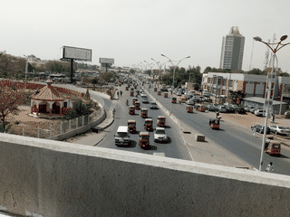
Ningi is one of 20 local government areas in Bauchi State, serving as a gateway between Bauchi and Kano regions. The semi-savanna town is known for its rocky hill outcrops, traditional Hausa-Fulani mud-brick compounds with decorative patterns, and lively weekly markets trading food, livestock, and crafts.
Before you go
Accommodation
Basic lodges and guesthouses available in town. For hotels with full amenities, travel to Bauchi or Kano.
Connectivity
MTN, Glo, Airtel, and 9mobile networks available. Mobile data works but public WiFi is rare.
Food
Local Hausa-Fulani dishes like tuwon shinkafa and miyan kuka are staples. Tea shops and kunu (fermented millet drink) are widely available.
Money
Cash is the primary payment method. Carry sufficient naira from major cities as ATM availability in Ningi is limited.
Transport
Shared taxis and minibuses connect Ningi to Bauchi (3 hr), Kano (4 hr), and Jos (4-5 hr). Within town, motorcycle taxis (acaɓa) and tricycles (keke napep) are common.