Overview
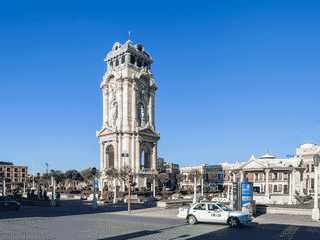
Metztitlán is a tiny Pueblo Mágico tucked into the Barranca de Metztitlán canyon, drawing Mexico City weekenders for hiking trails, birdwatching, and dramatic desert-and-canyon scenery. The colonial Centro packs cobblestone streets, centuries-old churches, and charming hotels into a walkable grid, making it an easy off-the-beaten-path escape without sacrificing comfort.
Architecture · Day Trips · Festivals · History · Nature
Before you go
Connectivity
Mobile coverage is available but not always reliable in canyon areas. WiFi is typical in hotels and some restaurants.
Culture
Metztitlán is a Pueblo Mágico—expect traditional festivals, indigenous Otomí culture, and a welcoming local atmosphere.
Health
The nearest hospital is in larger towns; carry basic supplies and any prescription medications. Altitude and heat can affect newcomers.
Money
Prices quoted in Mexican pesos (M$). Small local restaurants and taco stands are cash-only. ATMs may be limited; withdraw before arriving from larger towns.
Transport
Reaching Metztitlán requires a car or bus from Mexico City (3 hours) or Pachuca (under 2 hours). Within town, walk or rely on local taxis.