.jpg)
Kruger National Park
Africa · South Africa
See also
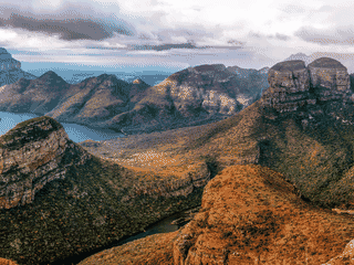

Blyde River Canyon
South Africa24.56°S 30.81°E
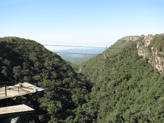

Graskop
South Africa24.97°S 30.82°E · 1,436 m
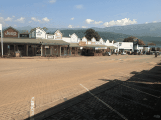

Sabie
South Africa25.17°S 30.80°E
Hazyview
South Africa25.03°S 31.12°E
Overview
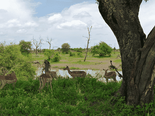
Kruger National Park is one of the biggest protected areas in South Africa and is widely considered to be one of the best national parks in the world. It covers 19,500 km² and is divided into 14 different ecozones, each supporting different wildlife.
Languages: Afrikaans, English, Southern Ndebele, Northern Sotho, Southern Sotho, Swazi, Tswana, Tsonga, Venda, Xhosa, Zulu
Why go?
Kruger National Park is one of the biggest protected areas in South Africa and is widely considered to be one of the best national parks in the world. It covers 19,500 km² and is divided into 14 different ecozones, each supporting different wildlife. With over 1.5 million visitors annually, it is the flagship of South African National Parks.
Adapted from Wikivoyage contributors · CC BY-SA 4.0
Get in
Kruger is accessible by car and air. Most visitors drive or rent a car. Major gates include Paul Kruger, Phabeni, Numbi, Malelane, Crocodile Bridge, Orpen, Phalaborwa, Punda Maria, and Pafuri. Nearby airports: Kruger Mpumalanga International Airport (KMIA) near Mbombela, Skukuza Airport inside the park, and Eastgate Airport at Hoedspruit. KMIA has flights from Johannesburg, Durban, and Cape Town.
Adapted from Wikivoyage contributors · CC BY-SA 4.0
Get around
Within the park, you drive yourself on a network of tar and gravel roads. Speed limit is 50 km/h. Self-driving is the most flexible way to see wildlife. Guided game drives and wilderness walks are also available from rest camps.
Adapted from Wikivoyage contributors · CC BY-SA 4.0
When to go
South Africa has reverse seasons relative to Europe and North America. Summer (September-April) is hot and sunny with occasional showers, temperatures 18-30°C. Winter (May-August) is warm and dry, temperatures 8-22°C. The dry winter months are best for game viewing as animals gather at waterholes.
Adapted from Wikivoyage contributors · CC BY-SA 4.0
Where to stay
SANParks operates numerous rest camps from basic to luxury. Budget options include campsites at Berg-en-Dal, Lower Sabie, Skukuza, and others. Basic bushveld camps like Balule, Tamboti, and Tsendze offer rustic experiences. Satara and Olifants are popular mid-range camps. Many camps have shops, restaurants, and swimming pools.
Adapted from Wikivoyage contributors · CC BY-SA 4.0
Eat and drink
Most main camps have shops selling raw food, wood, and charcoal for self-catering. Cafeterias and restaurants are available at camps like Skukuza, Lower Sabie, and Satara, offering South African specialties such as springbok tenderloin and biltong. Picnic sites like Tshokwane and Nkuhlu sell cooked food. Alcohol is banned for day visitors; overnight visitors can drink at their accommodation or camp restaurants.
Adapted from Wikivoyage contributors · CC BY-SA 4.0
See and do
The main attraction is wildlife viewing, including the Big Five (lion, leopard, elephant, buffalo, rhino). Birdwatching for the Big Six birds is popular. Archaeological sites like Masorini and Thulamela offer cultural history. Activities include wilderness trails (e.g., Bushmans Trail, Napi trail), night drives, and guided walks. The Skukuza Golf Course is a unique 9-hole course with wild animals.
Adapted from Wikivoyage contributors · CC BY-SA 4.0
Stay safe
Kruger is generally safe but wild animals are dangerous. Never leave your vehicle except at designated spots. Be cautious near hides and picnic sites, especially in areas where leopards and other predators are active. Follow park rules and speed limits.
Adapted from Wikivoyage contributors · CC BY-SA 4.0
Go next
Nearby attractions include Pilgrim's Rest, Blyde River Canyon, and the cities of Johannesburg and Pretoria (4 hours drive). Cape Town and Durban are farther afield. The Drakensberg mountains offer hiking and scenery. Border crossing to Mozambique via Giryondo is not practical for most visitors.
Adapted from Wikivoyage contributors · CC BY-SA 4.0
Field guide adapted from Wikivoyage contributors · CC BY-SA 4.0. Text has been adapted and organized for this guide. About our sources.
Places to know
A few starting points from the guide. Check current hours and prices before you go.
- eat
Afsaal Traders Rest
Afsaal is a rest stop along the road between Berg-en-Dal and Skukza. Here you can rent braais or skottels to cook for yourself. You can also buy the raw ingredients at the shop, as well as maps, t-shirts and other mementos. Tindlovu, who run many of the camp restaurants, also runs the restaurant at the Afsaal picnic spot, a lively picnic area along the H3, giving it convenient access from Berg-en-Dal, Pretoriuskop and Skukuza, as well as several smaller or private lodges in the area (such as Biyamiti, which doesn't have its own restaurant). It is also reasonably accessible from Lower Sabie and Crocodile Bridge.
Adapted from Wikivoyage contributors
- eat
Albasini Ruins
The Albasini ruins have a basic picnic site with no gas or shop. Toilet facilities are available nearby at Phabeni gate.
Adapted from Wikivoyage contributors
- eat
Babablala
This basic picnic area offers only toilet facilities (including wheelchair accessible toilets).
Adapted from Wikivoyage contributors
- eat
Berg-en-Dal
Adapted from Wikivoyage contributors
- eat
Cattle Baron Skukuza
Adapted from Wikivoyage contributors
- eat
Lower Sabie
Adapted from Wikivoyage contributors
- eat
Makhadzi
Northeast of Letaba, this quiet but historic site overlooking the Makhodzi river is one of the last stops in South Africa before the Giryondo border post taking one into Mozambique. Originally set up as a British fort during the Anglo-Boer war, the spot was a military base until 2003. The site has no facilities but does include information about the history of the area and the Great Limpopo Transfrontier Park.
Adapted from Wikivoyage contributors
- eat
Masorini
At the Masorini archaeological site is also a small picnic area with a kiosk selling drinks and renting out skottels as well as toilet facilities. It's about a 30-min drive from Phalaborwa or a 90-min drive from Letaba. It is also an access point for the Masorini 4x4 loop.
Adapted from Wikivoyage contributors
Before you go
Accommodation
Accommodation ranges from campsites (R320+) to luxury lodges. Book well in advance for popular camps.
Connectivity
Mobile network coverage is limited to camps and some main roads. SIM cards (Vodacom/MTN) are easy to buy at airports or shops. Wi-Fi is only available at a few camps like Skukuza.
Culture
Respect wildlife and park rules. Do not feed animals. Keep noise down. Learn some basics of Afrikaans or local languages for friendly interactions.
Health
Malaria is present in the park. Use mosquito repellent and consider prophylaxis. Sun protection is essential.
Local transport
Self-drive is the norm. The park has a network of tarred and gravel roads. Speed limit strictly 50 km/h. Guided drives can be booked at rest camps.
Money
Conservation fees apply: South African citizens R106/day, SADC nationals R212/day, international visitors R424/day (2024/25).
Safety
Do not leave your vehicle except at designated areas. Animals are unpredictable and dangerous.
Transport
Self-driving is the best way to explore. Gates are open from around 06:00 to 18:00. Speed limit 50 km/h inside park.
Visa context
Visa rules depend on passport; check current entry rules before booking.