Overview
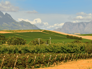
Worcester serves as the largest town in the Western Cape's interior and functions as the commercial hub for the Breede Valley region. The town is strategically positioned along the N1 highway, making it a practical stopover between Cape Town and the interior provinces.
History · Nature
Before you go
Money
South African Rand (ZAR) is the local currency. Shoprite supermarket and most establishments accept cash. Credit cards are likely accepted at larger establishments and the shopping mall.
Safety
Standard urban precautions apply in Worcester. The town is generally safe for travellers but exercise normal city awareness, particularly at night near the railway station and central business district.
Transport
The N1 highway passes through Worcester, making it a convenient stop between Cape Town (120km south) and interior provinces. Daily commuter trains and 2-3 weekly long-distance trains connect major cities.
Weather
Summers are extremely hot (often above 35°C, sometimes exceeding 40°C). Winters are cold and windy with snow on higher peaks. Spring and autumn offer the most comfortable temperatures for outdoor activities.