Overview
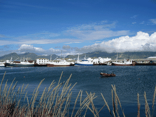
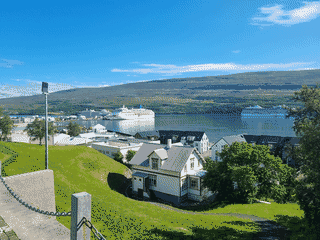
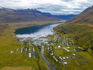
Seyðisfjörður is a ferry gateway with a connection to Nordic noir. Trapped used the town as a main filming location, and surrounding trails range from short walks to longer treks.
Transit Hub · Trekking · Culture
Did you know?
- Smyril Line links this Icelandic landfall with the Faroe Islands.
- Trapped used the town as a principal filming location.
- Hafaldan HI hostel occupies a former hospital.
Where it is
Seyðisfjörður is 395 km east of Reykjavík.
Why go?
Seyðisfjörður is primarily a transit hub — it's where the Smyril Line ferry from Denmark and the Faroe Islands makes landfall in Iceland. Beyond its ferry importance, the town gained fame as the primary filming location for the Nordic noir series Trapped (created by Baltasar Kormákur). For hikers, the surrounding area offers trails ranging from 30-minute walks to multi-day treks. The town also hosts the LungA Art Festival each summer, bringing young artists and performers to the community.
Getting in
The Smyril Line ferry connects Seyðisfjörður to Denmark (Copenhagen via Tórshavn, Faroe Islands) and the Faroe Islands. The ferry terminal is central, with the town built around the fjord. Overland access is via Route 93 from Egilsstaðir (about 65 km, roughly 1 hour drive). No airport in the town; the nearest is Egilsstaðir Airport.
Getting around
Seyðisfjörður is small enough to walk. The main street runs along the waterfront. Hiking trails start from the edge of town, leading into the surrounding mountains and along the fjord.
When to go
Summer (June-August) offers the best hiking conditions and the LungA Art Festival in July. Winter brings snow and limited daylight, though the fjord scenery is dramatic. The ferry operates year-round, but winter weather can affect road access to/from Egilsstaðir.
Where to stay
Accommodation options include Hótel Aldan (Nordurgata 2, from 6800 kr) and Hafaldan HI hostel (Ránargata 8, formerly the old hospital). Both offer the main options for overnight stays. Camping is possible in the surrounding area.
Food and drink
Skaftfell (Austurvegur 42) serves as the main restaurant and cultural hub, operated by the art association. The supermarket provides self-catering options. The town has a small selection of establishments given its size.
Connectivity
Free Wi-Fi is available at the tourist information centre, located right in front of the ferry terminal. For mobile data, Icelandic carriers Siminn, Vodafone, and Nova provide coverage.
Buy
A 24/7 ATM is located in the bank, about 100 m in front of the ferry terminal. A post office sits next to the bank. A supermarket provides basic supplies. The town is small with limited shopping options.
Go next
Egilsstaðir is the main onward destination, approximately 65 km via Route 93. It's the largest town in East Iceland and has an airport. From Egilsstaðir, you can continue around the Ring Road or fly to Reykjavík.
Guide text adapted from Wikivoyage contributors under CC BY-SA 4.0.
Where to start
Sleep
Hafaldan HI hostel
Sleep
Hótel Aldan
Price when recorded: from 6800 kr
Eat
Skaftfell, nettk@fe og bistro
See
Technical Museum of East Iceland
Price when recorded: 1000 kr for adults
Do
LungA Art Festival
Before you go
Connectivity
Free Wi-Fi at the tourist information centre in front of the ferry terminal. Major Icelandic carriers provide mobile coverage.
Money
Icelandic króna (ISK). ATMs available at the bank near the ferry terminal. Credit cards widely accepted.
Transport
The Smyril Line ferry from Denmark and the Faroe Islands is the main reason most travelers visit Seyðisfjörður. Route 93 connects to Egilsstaðir (65 km, ~1 hour).
Weather
Weather in the fjord can change rapidly. Summer offers mild temperatures and long daylight hours; winter brings snow and limited daylight.