Pululahua Geobotanical Reserve
South America · Ecuador
Did you know?
- The reserve's Quichua name refers to a cloud of water or fog.
- Pondoña Hill is a lava dome with a trail leading to its summit and small crater.
- Colonial lime kilns supplied material for Quito's whitewashed buildings.
See also
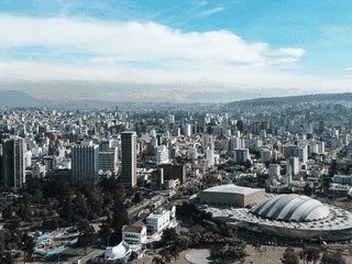

Quito
Ecuador0.25°S 78.58°W · 2,850 m
Otavalo
Ecuador0.23°N 78.27°W · 2,550 m
Mindo
Ecuador0.03°S 78.80°W
Overview
Pululahua Geobotanical Reserve protects a settled volcanic crater near Quito. Trails link open highland views with humid cloud forest inside the caldera.
Languages: Spanish
Why go?
Pululahua is one of the few inhabited volcanic craters in the world, offering a rare opportunity to trek through diverse ecosystems—from inter-Andean panoramic vistas to humid cloud forest—all within a 2500-year-old caldera. The reserve provides easy access from Quito for nature lovers seeking geological wonders, colonial history, and outdoor activities without extensive travel.
Adapted from Wikivoyage contributors · CC BY-SA 4.0
Understand
The name Pululahua derives from the Quichua words meaning "cloud of water" or fog, referencing the mist that frequently blankets the crater. The reserve was established due to its unique biodiversity and geological significance as a collapsed volcano with distinctive lava domes and diverse microclimates.
Adapted from Wikivoyage contributors · CC BY-SA 4.0
When to go
The reserve experiences temperatures ranging from 0°C to 27°C with rainfall between 500mm and 3000mm annually, creating varied microclimates throughout the crater. The dry season (June to September) offers the most stable conditions for hiking, while the misty cloud forest atmosphere persists year-round, adding to the landscape's dramatic character.
Adapted from Wikivoyage contributors · CC BY-SA 4.0
Get in
By car from Quito, drive past La Mitad del Mundo and continue toward Calacalí; after cresting the hill past the Mitad del Mundo valley, look for a dirt road on the right approximately 500m past the gas station—this marks the park entrance. By bus from Quito, take the Mitad del Mundo line on Avenida America near Universidad Central, disembark at the crater exit road about 5 minutes beyond La Mitad del Mundo, then walk 15 minutes uphill to El Mirador and 25 minutes down a steep dirt trail into the caldera.
Adapted from Wikivoyage contributors · CC BY-SA 4.0
Fees and permits
Foreign visitors pay an entrance fee of $5 (USD) to enter the Pululahua Geobotanical Reserve. This fee supports maintenance of trails and conservation efforts within the protected area.
Adapted from Wikivoyage contributors · CC BY-SA 4.0
Get around
Inside the reserve, narrow and steep roads require careful driving with a maximum speed of 20 km/h. Most exploration occurs on foot along established trails that wind through the crater floor, past lava domes, and to scenic viewpoints. The 1.4-km foot trail from El Mirador descends 300m to the caldera floor.
Adapted from Wikivoyage contributors · CC BY-SA 4.0
Things to do
The reserve features three primary geological attractions: Pondoña Hill, the central lava dome formed 500 years after the volcano collapsed with a trail to its summit and small crater; Chivo Rock, a southern lava dome with tent space at its summit and access to community water collection systems; and El Mirador, an observation terrace at 2833m with paved road access and panoramic caldera views. Historical limestone kilns dating to the colonial period—tall rock structures 3-5m tall—dot the area, where lime was produced for Quito's whitewashed colonial buildings.
Adapted from Wikivoyage contributors · CC BY-SA 4.0
Do
Horseback riding, trekking, and mountain biking rank as the most popular activities within the volcano trails. Trails traverse ecosystems from panoramic inter-Andean valley views to rainy cloud forest, many established by indigenous communities over centuries. The area holds archaeological significance—Yumbo commercialist trails connect to Tulipe 29 km southwest, while Caranqui pyramid trails lead to Alance 15 km northeast.
Adapted from Wikivoyage contributors · CC BY-SA 4.0
Where to stay
Accommodation within the crater is limited to a few basic options. The Pululahua Hostal offers the most established lodging with organic food available from local producers. El Leñador and La Rinconada provide additional budget-friendly rooms with typical Ecuadorian meals. Staying overnight allows hikers to explore the caldera floor before day-trippers arrive.
Adapted from Wikivoyage contributors · CC BY-SA 4.0
Eat
Food options concentrate around El Mirador and within the caldera. Local vendors at El Mirador sell typical products and crafts. The Crater Restaurant serves meals for those descending into the caldera, while Pululahua Hostal offers organic food grown within the crater including coffee, corn, beans, and guinea pig. La Rinconada and El Leñador provide additional typical Ecuadorian dining.
Adapted from Wikivoyage contributors · CC BY-SA 4.0
Buy
Crafts and souvenirs are available from local vendors at El Mirador viewpoint. For organic products, descend into the caldera where local producers sell coffee, corn, beans, guinea pigs, and pork at the Pululahua Hostal.
Adapted from Wikivoyage contributors · CC BY-SA 4.0
Stay safe
The Pululahua Geobotanical Reserve is considered safe for tourists. Visitors should exercise standard precautions regarding belongings and be aware that trails involve steep, uneven terrain requiring appropriate footwear. The descent into the caldera involves a 25-minute steep dirt path that can be slippery in wet conditions.
Adapted from Wikivoyage contributors · CC BY-SA 4.0
Day trips
Pululahua serves as an ideal half-day excursion from Quito, easily combined with a visit to La Mitad del Mundo (the equatorial monument) located just 5 minutes away. The archaeological site of Tulipe, 29 km southwest, offers Yumbo cultural history connected to Pululahua through ancient trails.
Adapted from Wikivoyage contributors · CC BY-SA 4.0
Go next
Quito, Ecuador's capital, lies 17 km south and serves as the primary hub for continuing journeys into the Andean Highlands or onward to other destinations. Ibarra, a colonial city in the northern highlands, offers another avenue for exploring Ecuador's northern highlands region.
Adapted from Wikivoyage contributors · CC BY-SA 4.0
Field guide adapted from Wikivoyage contributors · CC BY-SA 4.0. Text has been adapted and organized for this guide. About our sources.
Places to know
A few starting points from the guide. Check current hours and prices before you go.
- sleep
El Leñador
Simple rooms and typical food in the reserve area.
Adapted from Wikivoyage contributors
- sleep
Hotel La Rinconada
Basic accommodation with typical Ecuadorian meals available.
Adapted from Wikivoyage contributors
- sleep
Pululahua Hostal
The main accommodation option inside the crater, offering rooms and organic food from local producers.
Adapted from Wikivoyage contributors
- eat
Crater Restaurant
Restaurant serving meals at the caldera floor level.
Adapted from Wikivoyage contributors
- eat
El Mirador Vendors
Local vendors at the observation terrace selling typical Ecuadorian products and quick snacks.
Adapted from Wikivoyage contributors
- see
Chivo Rock
Southern lava dome with summit trail and space for two tents; water collection tanks at base serve the local community.
Recorded price: Included in $5 entrance fee
Adapted from Wikivoyage contributors
- see
El Mirador
Observation terrace at 2833m with panoramic views of the caldera, Pondoña Hill, Chivo Rock, and agricultural west side.
Recorded price: Included in $5 entrance fee
Adapted from Wikivoyage contributors
- see
Limestone Kilns
Twelve colonial-era kilns (3-5m tall) where lime was produced for Quito's whitewashed buildings; historical industrial heritage site.
Recorded price: Included in $5 entrance fee
Adapted from Wikivoyage contributors
Before you go
Connectivity
Mobile phone coverage is limited inside the crater. Signal improves at El Mirador viewpoint. WiFi is not available within the reserve.
Food
Basic meals available at El Mirador vendors and crater restaurants. Organic local products including coffee and produce can be purchased from the hostal inside the caldera.
Money
Entrance fee is $5 USD for foreigners, paid at the park entrance. Local currency is US dollars in Ecuador.
Packing
Bring layers for changing temperatures, sturdy hiking shoes for steep trails, rain gear, sun protection, and water. The 25-minute descent into the caldera is steep—hiking poles are helpful.
Safety
The reserve is considered safe. Main hazards are steep trails and changeable weather. Drive slowly on narrow crater roads at maximum 20 km/h.
Transport
Buses to Pululahua depart from Avenida America near Universidad Central in Quito, costing a few dollars. By car, the drive takes approximately 45 minutes to 1 hour from central Quito.
Weather
Temperatures inside the crater range from 0°C to 27°C depending on altitude and season. Rain gear is recommended year-round due to frequent fog and mist.