Overview
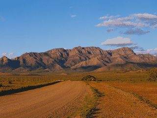
Port Augusta is the "Gateway to the Outback" and "Crossroads of Australia", situated where five major highways converge at the top of Spencer Gulf. This regional centre of about 12,000 people serves as a critical transit hub for travelers heading between Perth, Darwin, Adelaide, and beyond.
History · Nature · Transit Hub
Before you go
Food
Daytime offers cafes and coffee shops in town centre. After hours, options are limited to pubs, clubs, roadhouses, and fast food. A 24-hour roadhouse and Hungry Jacks serve late-night travelers.
Money
Standard Australian currency (AUD) is used. ATMs are available at local banks. The town has Woolworths, Coles, and Big-W for supplies and provisions.
Transport
Port Augusta is a major road junction where five highways converge: Eyre Highway to Perth, Stuart Highway to Darwin, Lincoln Highway to Port Lincoln, Flinders Ranges Highway to the northeast, and routes to Sydney. The Ghan and Indian-Pacific railways both pass through town.
Weather
Port Augusta experiences hot summers typical of outback South Australia. The arid climate means low rainfall. Winters are milder. Be prepared for extreme temperatures if traveling further into the outback.