Overview
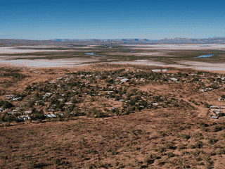
Kununurra is a small outback town of 4,500 people created in 1958 when the Ord River was dammed, turning a remote corner of the Kimberley into fertile farmland. It's the practical base for exploring Lake Argyle (Australia's second-largest artificial lake), Mirima National Park with its miniature Bungle Bungle rock formations, and the famous Purnululu (Bungle Bungle) National Park further south.
Budget Travel · Day Trips · History · Nature · Trekking
Before you go
Connectivity
Telstra 4G in town only; no signal on highways. Free internet at Community Library with WA State Library card.
Culture
Miriwoong people are traditional owners of the area. Two Aboriginal art galleries showcase Kimberley artists. Respect local customs and ask permission before photographing indigenous people.
Money
Prices are high due to transport costs. Australian dollars (AUD) used everywhere. Card accepted at most places; Ord River Roadhouse is open 24 hours for fuel and supplies.
Packing
Bring plenty of water (5-10 litre containers recommended), sun protection, and any special items needed—shopping options are limited and expensive.
Safety
Crocodiles in ALL waterways—never swim without local advice. Sun protection essential year-round. Roads can flood during wet season.
Transport
Kununurra Airport (KNX) is 4 km west of town with flights from Broome, Darwin, and Perth. Car hire is essential for exploring beyond town. Driving is relaxed with no traffic lights.
Weather
Dry season (May-Sep) is best for travel with 30°C days and blue skies. Wet season (Oct-Apr) brings heavy rain, flooding, and intense humidity with feels-like temps up to 49°C.