Overview
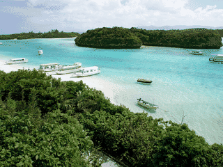
Iriomote is Japan's last great wilderness island, with 90% of its 153 km² covered in dense jungle and mangrove swamps. Home to the endangered Iriomote wildcat found nowhere else on Earth, the island was inscribed as a UNESCO World Heritage Site in 2021 alongside Tokunoshima, Amami Oshima, and northern Okinawa.
Beach · Day Trips · Diving · Island · Nature
Before you go
Activities
Most tours (kayaking, diving, waterfall hikes) require advance booking. English-speaking guides available but limited—GreenRiver and Canoe Tours Kazaguruma are reliable options.
Connectivity
Softbank 3G/4G only in coastal areas; much of the island interior has no signal. Download offline maps and inform people of limited contact options.
Money
Japan's cash culture applies here; carry sufficient yen as credit cards are rarely accepted outside major hotels. No ATMs on the island—withdraw in Ishigaki before departure.
Safety
Very safe island overall. Main risks: muddy jungle trails, river crossings, sun/heat. Emergency evacuation requires helicopter or boat to Ishigaki.
Transport
No airport on Iriomote—must arrive by ferry from Ishigaki (35-40 min rapid, 2-3 hours slow). Ferry tickets book up fast in peak season.
Weather
Typhoon season August-September can disrupt ferry services. Summer is hot and humid; winter mild but rainy. Spring/autumn best for hiking.