Overview
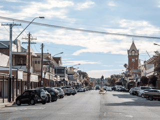
Pooncarie is a town of 226 people (2021) in the Lower Darling region of Outback New South Wales, one of the state's least visited towns. It exists primarily as a waypoint for adventurous travelers traversing the unsealed Pooncarie Road between Menindee and Wentworth, and as a fuel and accommodation stop before visiting Mungo National Park's northern sections.
Budget Travel · Day Trips · Nature
Before you go
Connectivity
No connectivity information provided in the article. Remote outback location suggests limited mobile coverage and WiFi.
Money
As a tiny outback town, cash is likely essential. No ATMs are mentioned in the article. Credit card acceptance is uncertain at the hotel and cafe.
Safety
Check Bureau of Meteorology (bom.gov.au) for flooding conditions before traveling. Darling River flooding can strand visitors for days. River water quality is poor—avoid swimming.
Transport
Only unpaved roads connect Pooncarie to surrounding towns. A weekly CDC Broken Hill bus runs Mondays between Mildura and Broken Hill. Town is walkable at under 2 km².
Weather
Outback NSW experiences extreme temperatures. The region is prone to drought and flooding depending on Darling River conditions. Check forecasts before visiting.